Picture yourself on a hike where you experience 26 waterfalls, trek between 2 glaciers and 2 volcanos. Sound like the best day ever?! Allow us to introduce you to the best day hike in Iceland called, Fimmvörðuháls! Truly it’s hands down our favorite hike to do during a sunny summer day. Therefore, we would love to share with you a step by step guide to planning your trip and hiking it safely!
Best Day Hikes in Iceland
Maybe when you plan your self-drive trip around Iceland, you’ll want some awesome day hikes to do! But likely you have no idea what to consider. Well good news, help has arrived! For example, some really awesome ones we have profiled and shared step by step directions follow below. Therefore, we encourage you to click the links to the best day hikes in Iceland and plan away! …and keep reading after so you get all of the details on Fimmvörðuháls too!
- Múlagljúfur
- Stórurð
- Rauðufossar
- Stuðlagil
- Glymur
- Fuglabjarganes
- Kerlingarfjöll Hot Spring
- Hengifoss & Litlanesfoss
- Stakkholtsgjá
- Helgufoss
- Vestdalsfossar
- Hveradalir
- Landmannalaugar
- Selfoss & Hafragilsfoss Waterfalls

Not to be Missed Trek
If you have an extra day in South during summer and want to embark on a full day adventure on your own two feet. Especially if the weather in Iceland is favorable, do not miss the Fimmvörðuháls hike! Likely you’ll find it is the most picturesque hike in Iceland. But be prepared to commit 8-12 hours to experience these very different and dynamic landscapes. Meanwhile, this trek is best done between July and August. Why? Daylight hours, weather, and trail conditions being the main reasons.
What to Pack & When To Go
Deciding on what to pack can be the most overwhelming part of planning your Fimmvörðuháls hike. However, don’t stress! In fact, our Iceland Wedding Planer team shares with you a complete list on what to wear and bring…
Clothing: Layer Up!
- Wool thermals.
- Windproof and quick drying hiking pants.
- Windproof and quick drying jacket.
- Quick drying softshell.
- Light gloves.
- Light hat.
- Wool socks (and extra pair).
- Hiking boots that support your ankles.
Inside Your Backpack
- Day backpack.
- Sunglasses.
- Sunscreen (reapply throughout the hike).
- Navigation equipment (IE, Hiking GPS / phone with GPS / Apps loaded with offline maps).
- Hiking Poles (they can be really useful on the way up and for balance on the way down).
- Water Bottle. Special Note: After you see the 26 waterfalls and cross the bridge there is no more drinking water from streams along the way. Therefore, make sure you have some to bring for the last 2/3’rds of the hike.
- Food: You’re going to be hiking for 8-12 hours so bring what you need to keep your energy up! For instance, protein bars, sandwiches, and other snacks.
- Crampons and an ice axe.
- Miscellaneous: Bring your bathroom supplies (paper, plastic bag, etc) and some cash as well if you wish to use the bathrooms at the mountain huts or buy any supplies along the way.
When to Hike the Trail
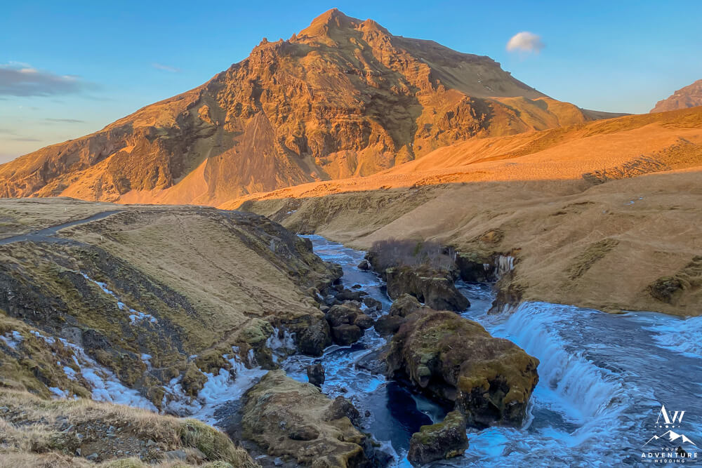
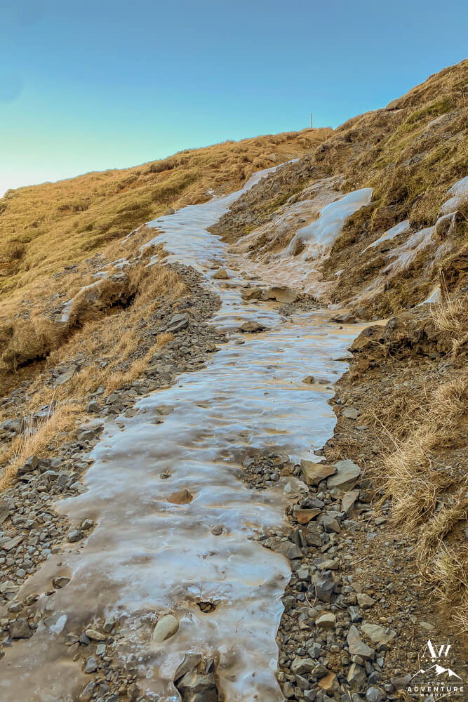
*Please Note: Fimmvörðuháls takes you over 3,000 feet above sea level vertically and during certain times of the year and conditions crampons are required to complete the hike safely. To illustrate, the photos shared in this blog post are from July 17th and October 22nd (the sunrise looking waterfall shots) and you see snow and ice is around. Therefore, to be the safest and lightest in packing, embark on the hike in late July or mid August only.
Choosing Your Ramble Direction
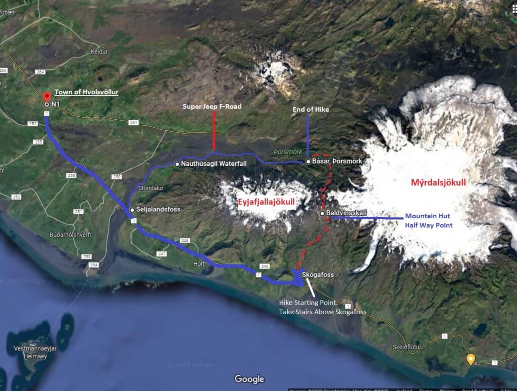
In order to experience the Fimmvörðuháls hike fully in our opinion, it is best to go from the top of Skogafoss to Thórsmörk. Why? Because you will see all of the waterfalls on the way at eye level and constantly be inspired. Whereas, going the other direction (Thórsmörk to Skogafoss) you will be looking behind to find the waterfalls which is slightly less exciting. Also, by going Skogafoss to Thórsmörk you can continuously fill up your water bottle along the way for the first 1/3 of the hike and fill up one last time before finishing the last 2/3rds.
Transportation to and from Fimmvörðuháls Trail
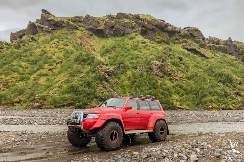
The Fimmvörðuháls hike is not a typical loop hike where you park, hike in, out, and come back to your vehicle. Rather, it begins at one point and ends miles and valleys away. So wait, then what the heck do you do? Zero stressing, we will happily give you options! Firstly, our personal favorite if you’re a local (and F-Road rated 4×4, ideally with snorkel incase river crossings are surging) or can team up with another couple.
For example, in going this route, you could both drive in stay the night (book in advance) at the Volcano Huts, Ferðaáætlun Útivistar Huts, or camp the night before and night of the hike. Note: You drive to Thórsmörk the night before and the following morning you drive to Skogafoss waterfall (in one vehicle) to begin the hike. Once the hike is completed, you end up back in Thórsmörk and then retrieve your other vehicle the next morning.
Secondly, if you do not have the luxury of 2 F-Road rated 4×4’s, the the alternative option is taking the bus to take you in and out. To illustrate, you leave your car (any type) at Skogafoss Waterfall, do the hike, and then plan to take the bus from Þórsmörk to Skógar that evening or the next morning.
Thirdly, if you want a slightly more exciting experience, choose to do a prearranged super jeep transport out of Thórsmörk. For instance, you would park at the fuel station N1 in Hvolsvöllur and catch the Southcoast Adventures super jeep / mini bus to drop you off at Skogafoss Waterfall to begin your hike. Then if you book in advance round trip service, then they would pick you back up at Húsadalur/Volcano Huts; Langidalur; or Básar and take you back to N1 or Skogar depending on your selection.
Guide to Hiking Fimmvörðuháls 2022
Okay so now comes the exciting park… Specific details on the Fimmvörðuháls Trail as of 2022! Although the famed hike is picturesque in every way possible, it is also pretty challenging in parts. Therefore, planning and preparing for it is important as we shared above.
Also, another very critical aspect of planning your Fimmvörðuháls hike during the summer months is checking the weather, wind, and conditions before you go. You do this by checking out Vedur and Safe Travel. Furthermore, if you intend on doing the hike, it’s good to have 2-3 days in the area as a buffer in case weather is forecasted to be extreme. That way you can choose the best day of the 2 or 3 to embark on it.
What to Expect: Fimmvörðuháls Trek Specifications
- Distance: ~15.5 miles one way (25 km).
- Hike Time: 8-12 hours (one way) depending on your pace and photo stop.
- Terrain: Stairs, stones, loose rocks, dirt/mud, grass, marsh, slippery rocks, bridge, sand, snow / ice, volcanic rocks, lots of up and down, chains and narrow ledges.
- Elevation Gain: ~4,600 feet (1,400 meters)
- Difficulty: Moderate to Challenging
- Google Map Link to Skogafoss Parking Lot.
- Best Time to Hike: Mid June – August
- Notes:
- Between the months of September – Early June, it is best that you hire a local guide to be with you. That way they bring the proper gear to cross successfully.
- The 26 Waterfalls are on private property, be respectful while visiting. For example, keep hold of your trash, pick up any you find, and stay on the marked trails.
- Bring your lunch and/or dinner with you in your backpack in case you want to spend more time here. Just make sure the bottom line is that you LEAVE NO TRACE!
Step by Step Directions to Hiking Fimmvörðuháls
Amped up and ready to do this thing?! Heck yes! So let’s get started…
-

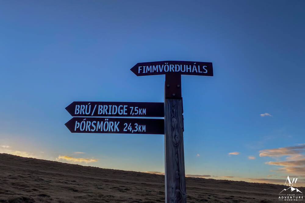
- Fimmvörðuháls Hike sign.
-
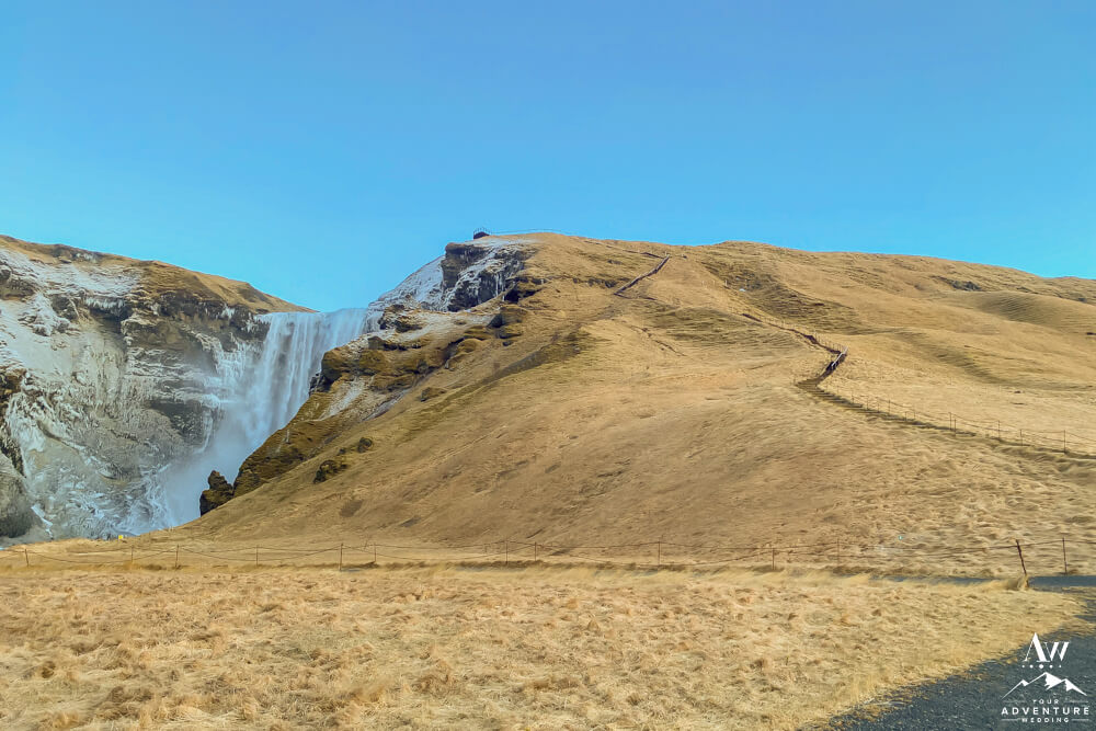
- Fimmvörðuháls Hike Begins at Skogafoss Waterfall in Skogar.
-
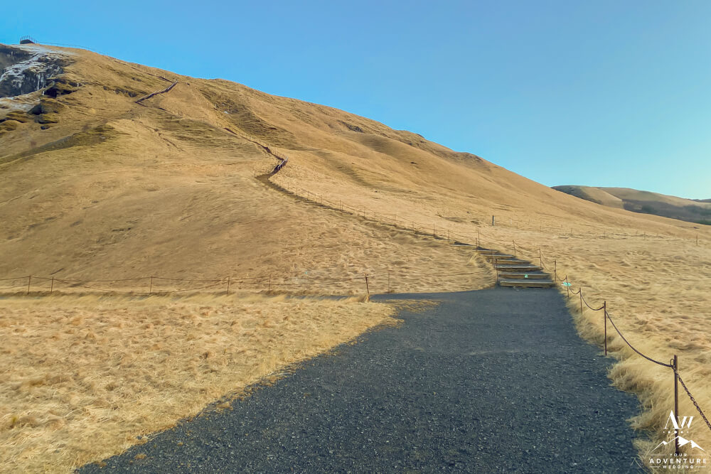
- You will follow the long staircase up (~350+ stairs).
-
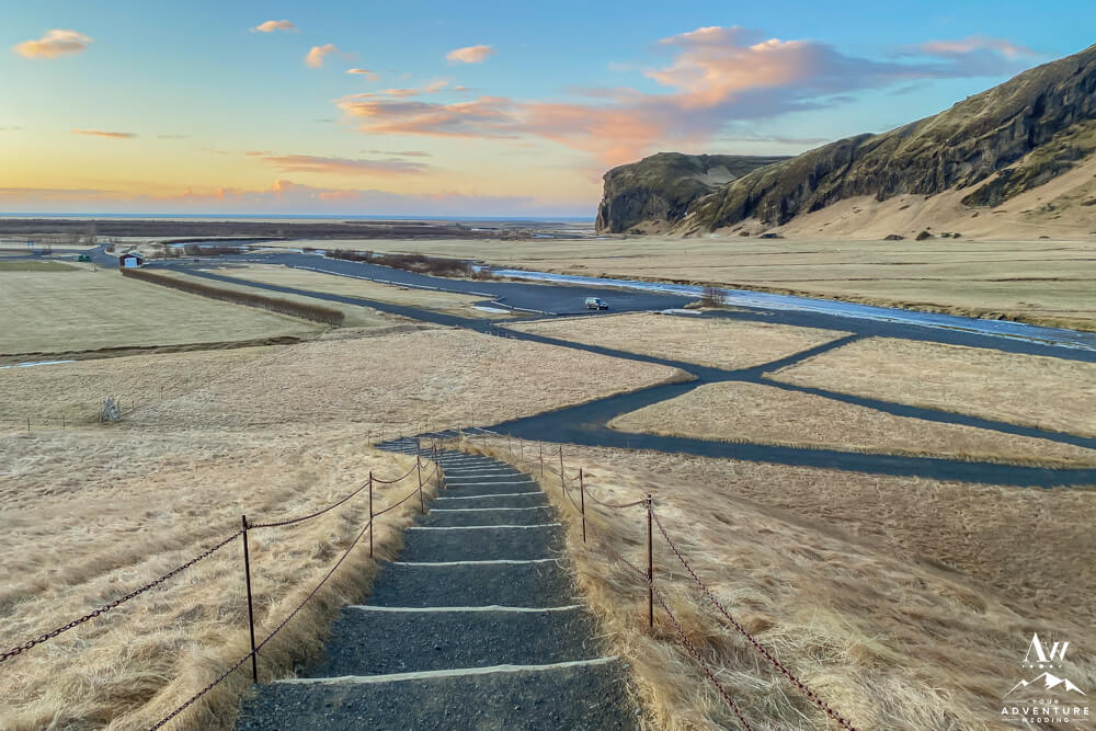
- View looking back on the stairs towards the parking lot at Skogafoss.
-
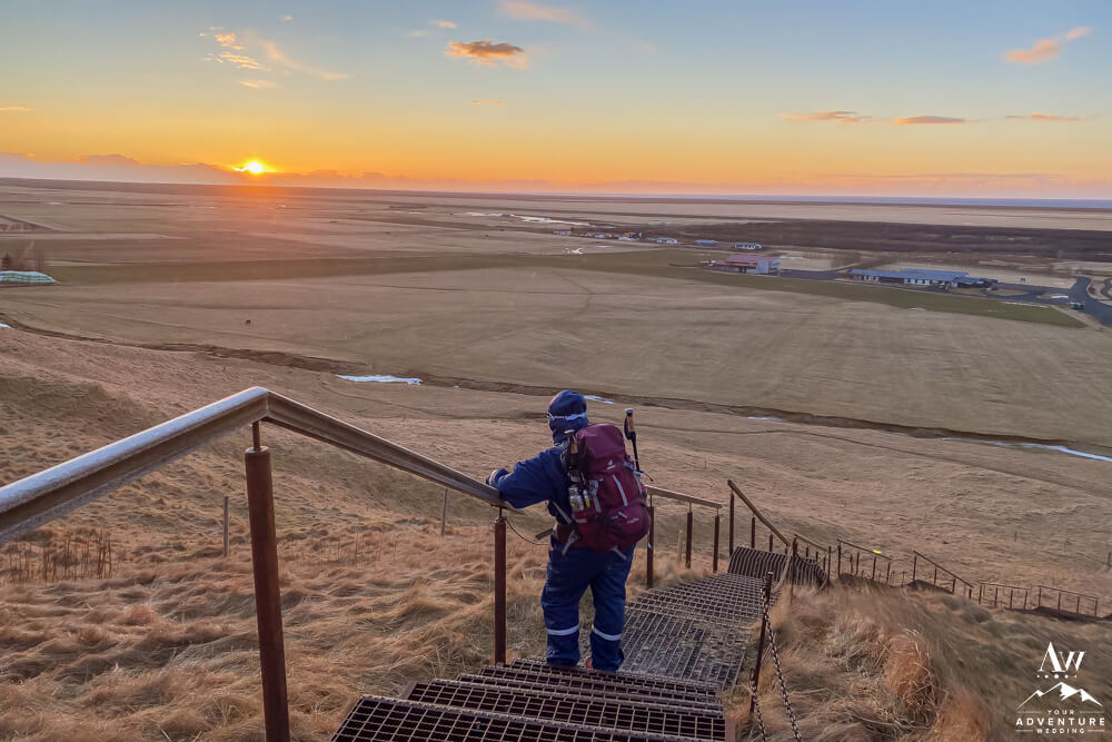
- Hiker on the Skogafoss staircase enjoying an October sunrise.
-
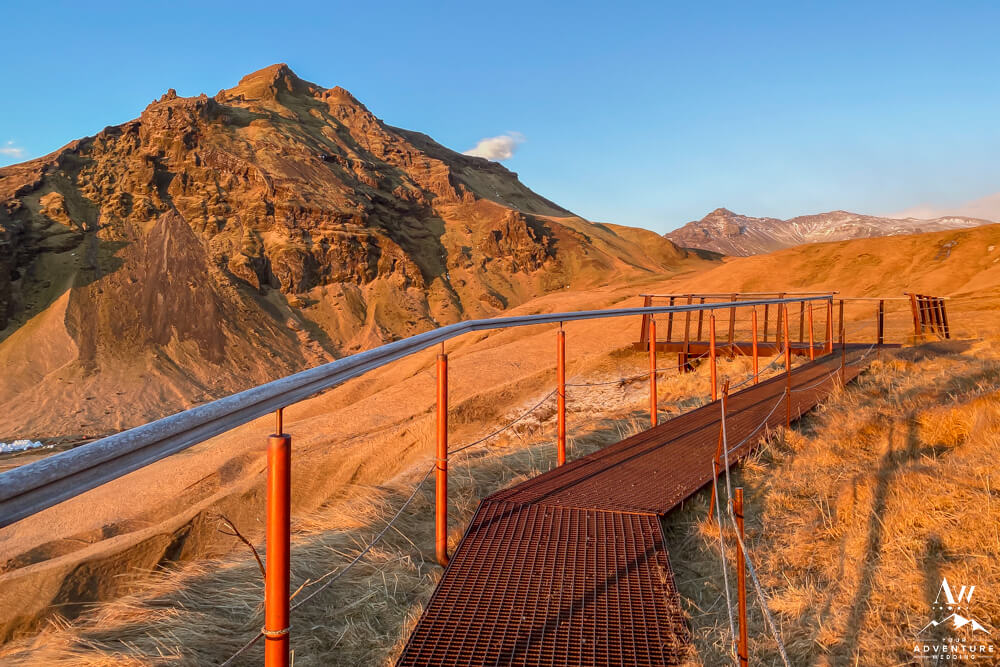
- The stairs at the top of Skogafoss turns unto a platform walk way.
-
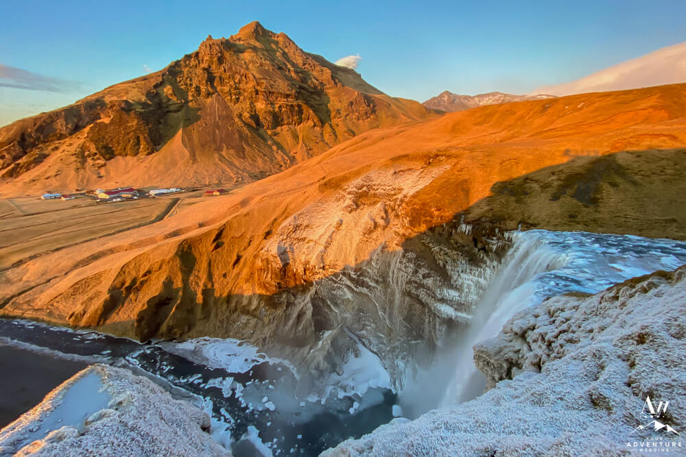
- View of the top of Skogafoss in mid-October.
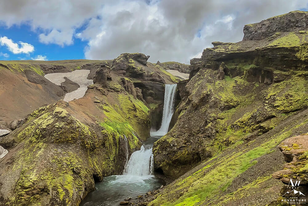
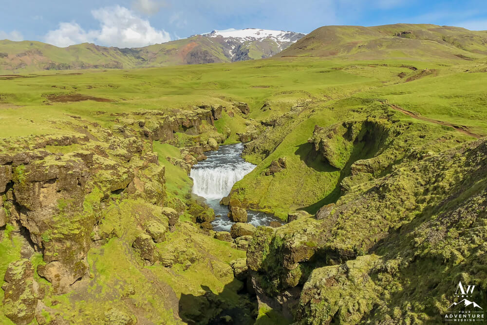
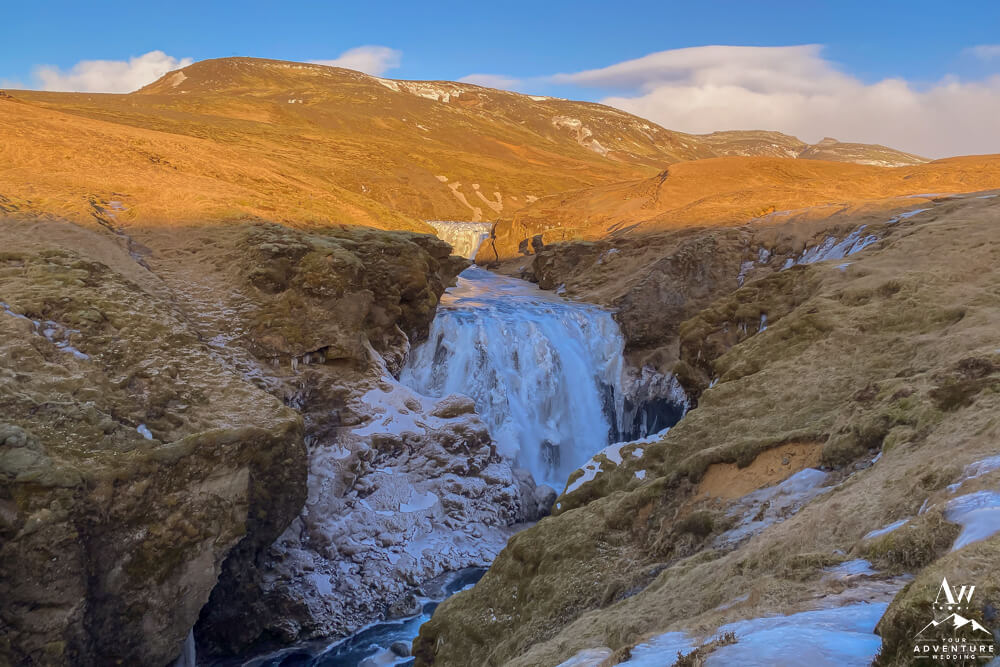
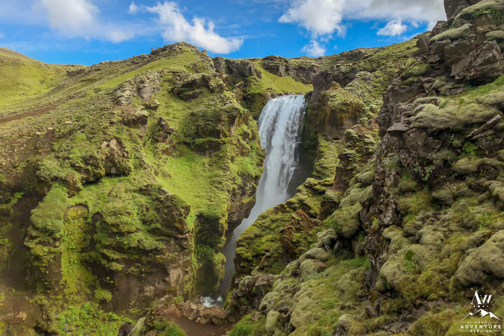
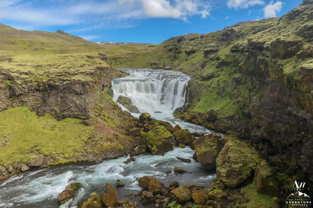
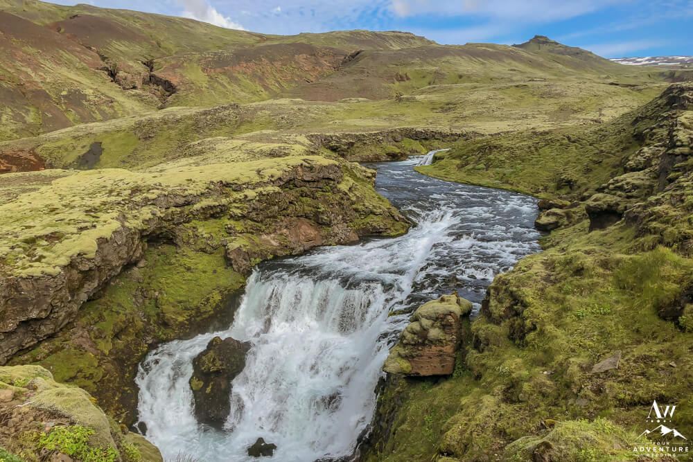
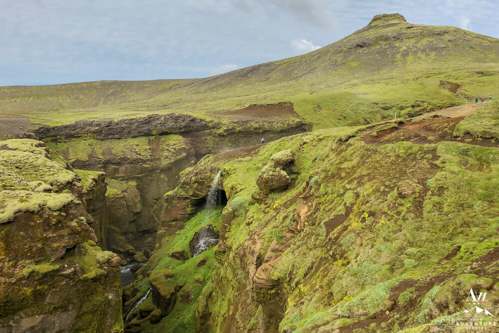
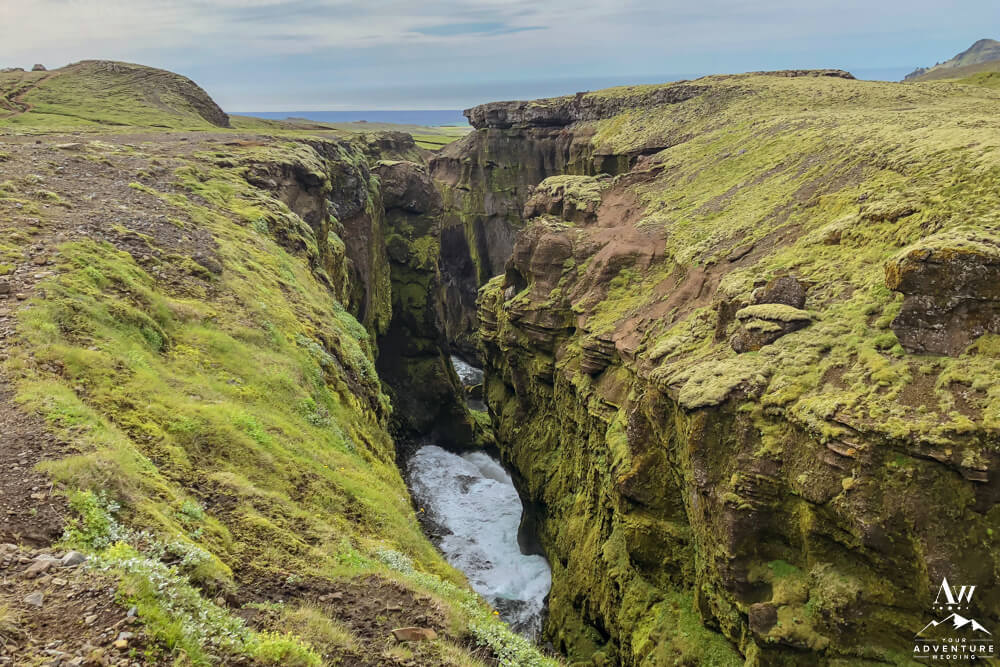
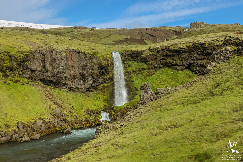
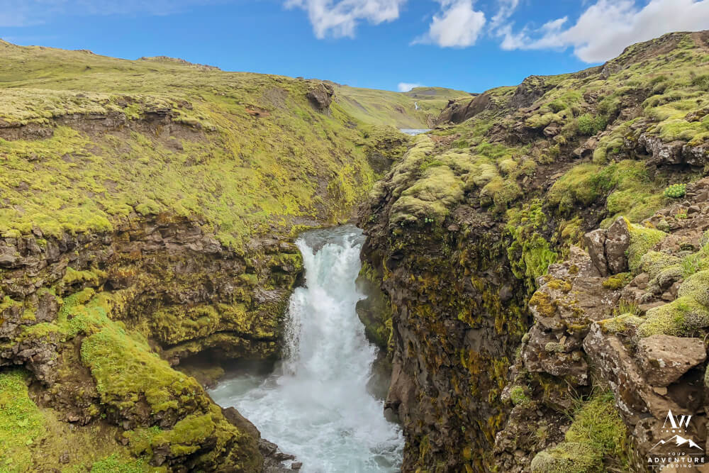
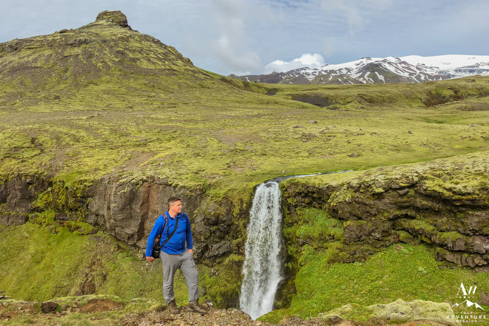
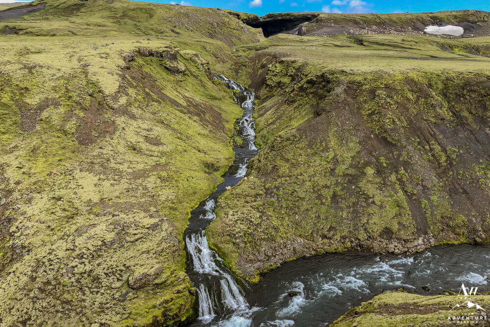
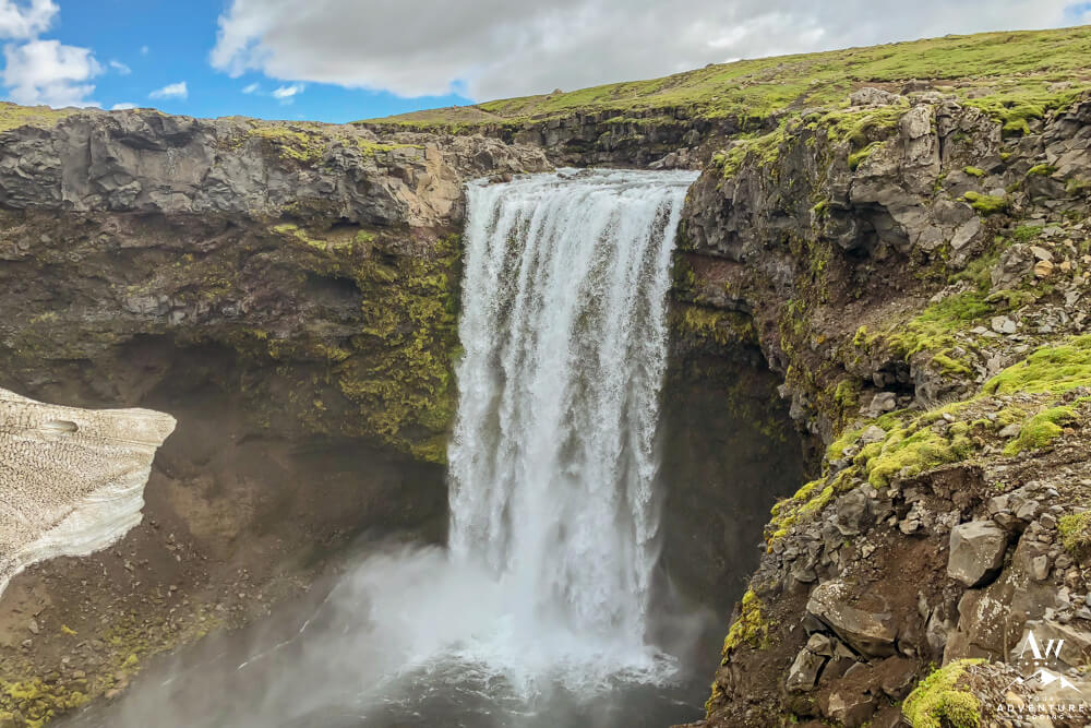
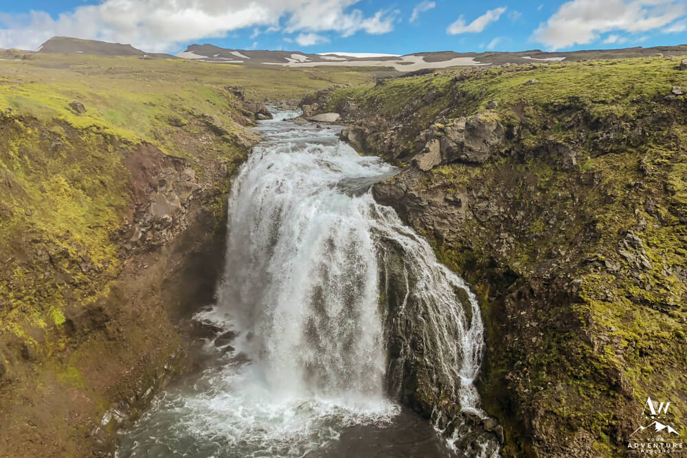
Experiencing 26 Waterfalls
Oh la la, after the stairs to the top of Skogafoss, you instantly witness the start of the 26 waterfalls. And in going this direction, you experience them all head on. Be aware, not all of the waterfalls have signs and names, but the ones that do we share below in order of witnessing! NOTE: The Fimmvörðuháls waterfall photos below were taken in late October and mid July so you can see the time of year difference.
-
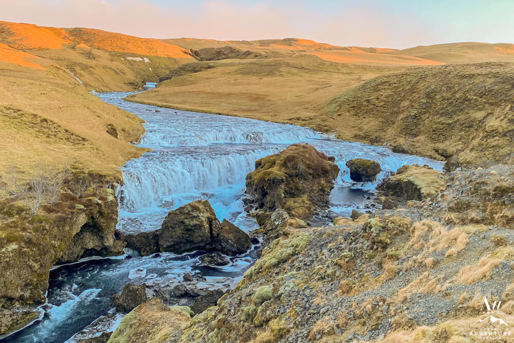
- Waterfall #2 you experience after Skogafoss (#1).
-
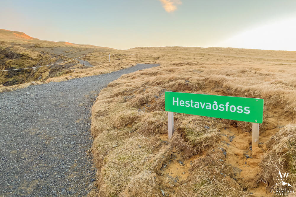
- Hestavaðsfoss second waterfall on the Fimmvörðuháls hike.
-

- Hestavaðsfoss in mid-July.
-
- Side view of Hestavaðsfoss in late October.
-

- July view of the side of Hestavaðsfoss.
-
- Waterfall #3 Fosstorfufoss Waterfall
-
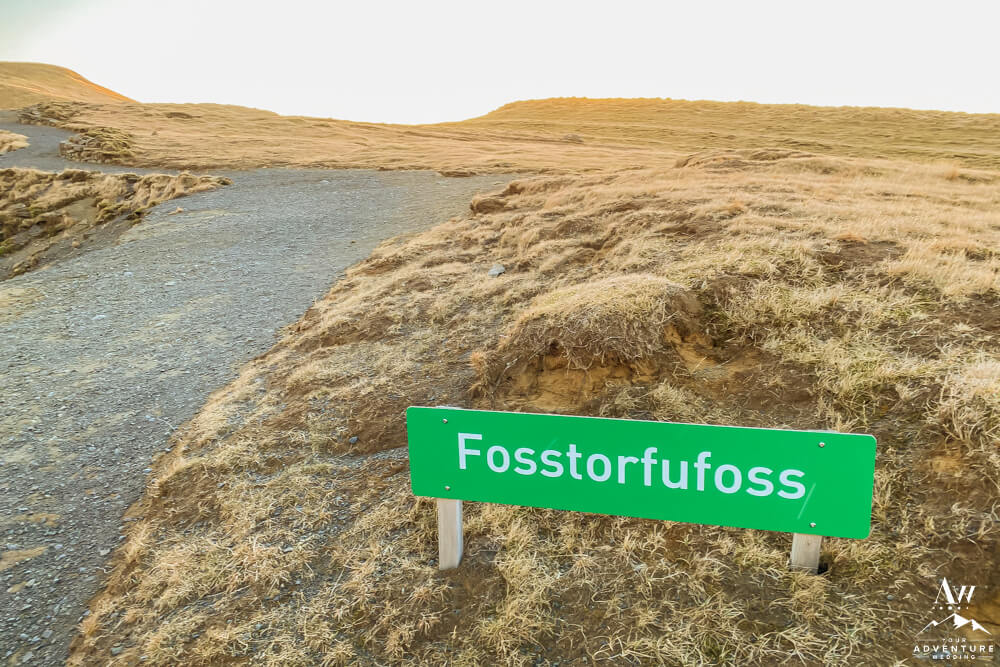
- Fosstorfufoss sign on the Fimmvörðuháls trail
-
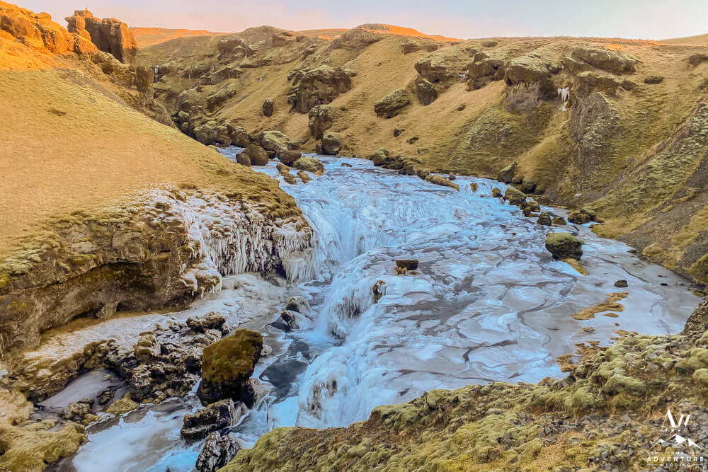
- Fosstorfufoss in late October.
-
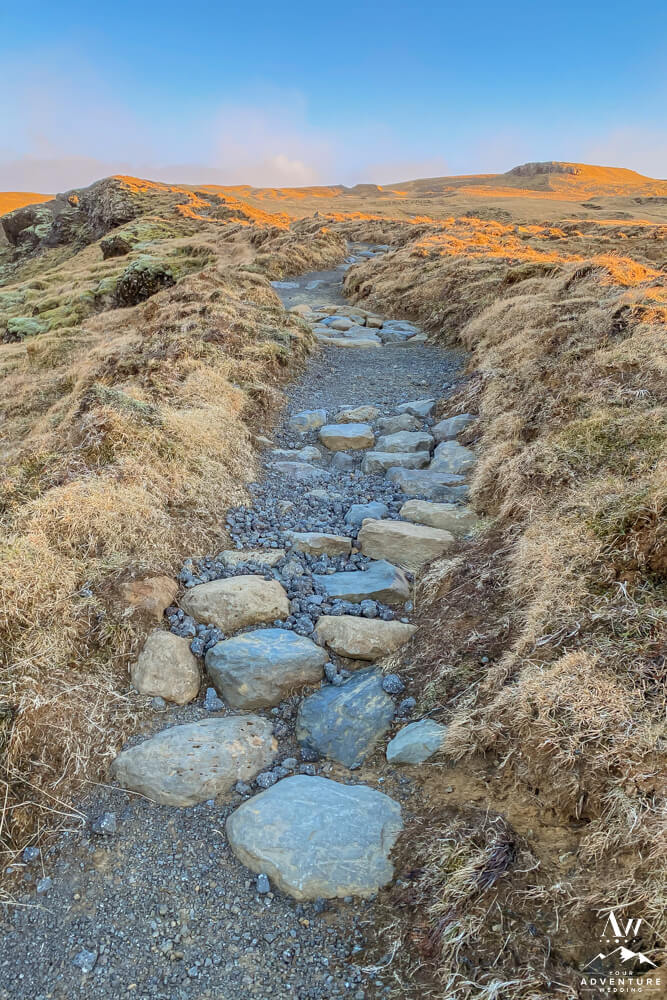
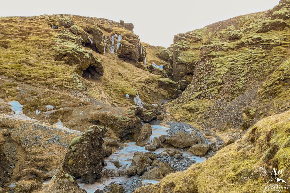
- Terrain is rocky, stone, dirt, and can be muddy or dusty depending on weather conditions.
-
- Fimmvörðuháls trail conditions in late October.
-
- Bringing crampons no matter the month can be beneficial!
-

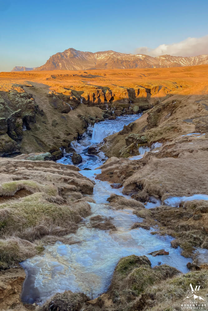
- Waterfall #4: Steinbogafoss
-
- Trail heading to Steinbogafoss
-

- Sign for Fremri-Fellsfoss
-
- Waeterfall #5: Fremri-Fellsfoss in July.
-
- Fremri-Fellsfoss in October.
-
- During summer this sweet little canyon is the perfect spot to fill your water bottle!
-

- Innri-Fellsfoss on the Fimmvörðuháls Hike.
-
- Waterfall #6: Innri-Fellsfoss Waterfall above Skogafoss
-
- Waterfall #7: Rollutorfufoss
-
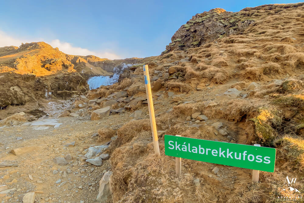
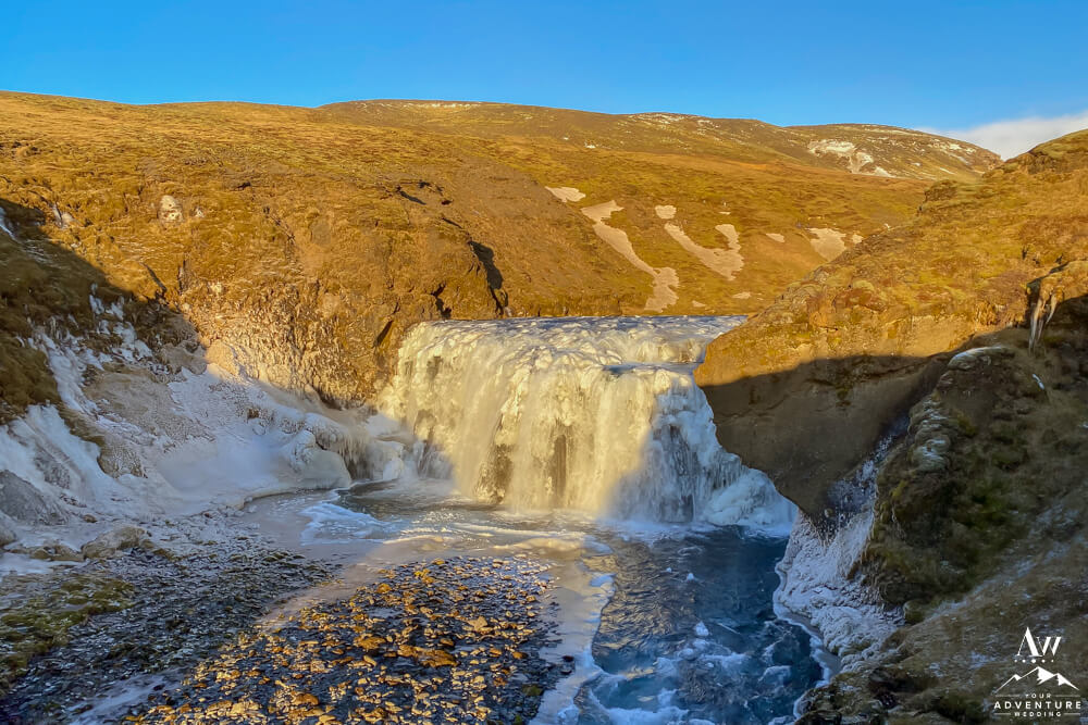
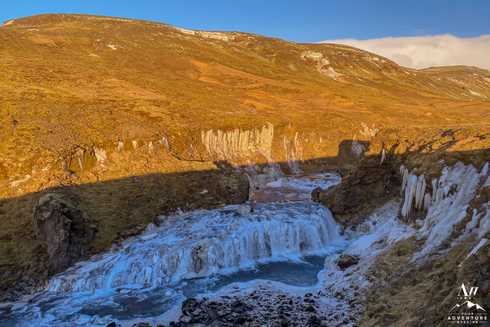
- Skálabrekkufoss the eighth waterfall on the Fimmvörðuháls Hike.
-

- Waterfall #8: Skálabrekkufoss in October
-
- Skálabrekkufoss in mid-July.
-

- Waterfall #9: Kæfufoss
-
- Waterfall #10: Kæfufoss
-
- Kæfufoss close up in July.
-
- Waterfall #11: Gluggafoss
-
- Waterfall #12: Bonus waterfall, no name!
-
- View looking back into the canyon on the Fimmvörðuháls trail.
-
- Waterfall #12: Króksfoss
-
- Waterfall #14: Neðstifoss
-
- Waterfall #15: Unknown Name.
-
- Waterfall #16: Efstifoss
-
- The views are just so lovely in summer!
-
- Waterfall #17: Miðfoss
-
- Waterfall #17: Slaedufoss
-
- Waterfall #18: Uknown Name.
-
- Waterfall #19: Name Unknown. There were other smaller waterfalls, I did not photograph due to time but all 26 are there!
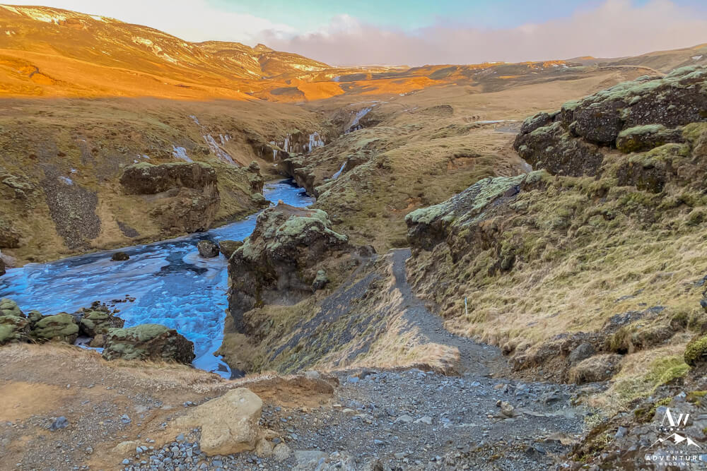
::Warning:: Once you cross the bridge, there is NO WHERE to fill your water bottle up. So make sure you fill up before or at this point before continuing!
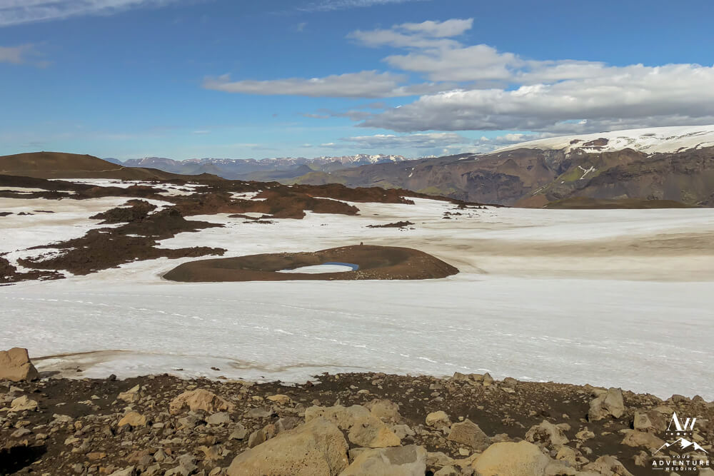
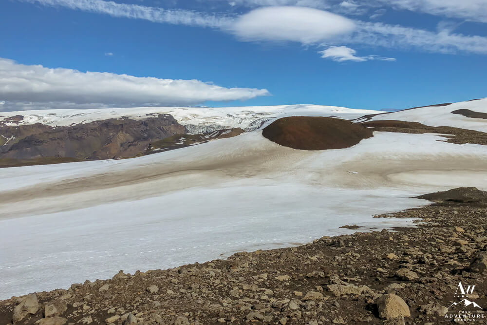
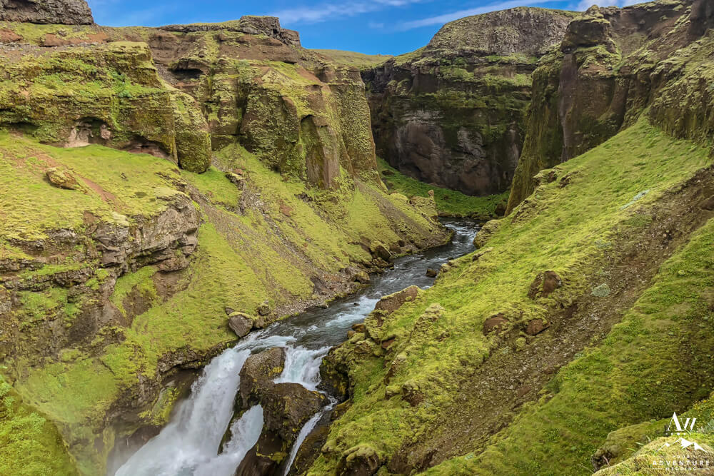
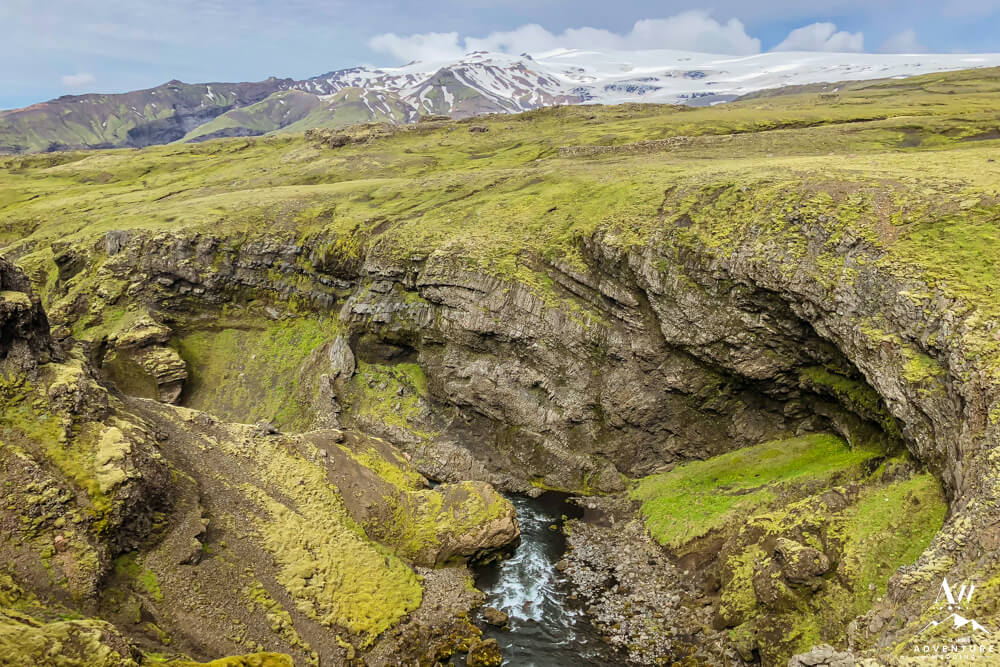
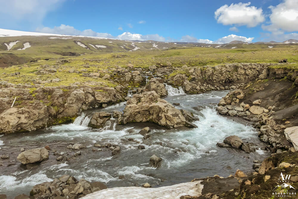
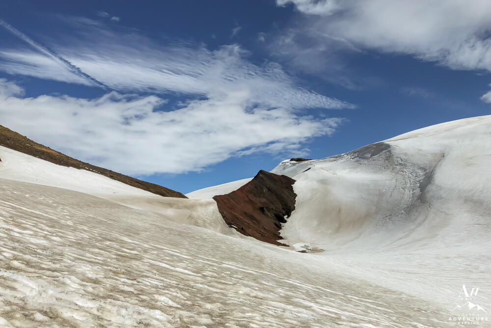
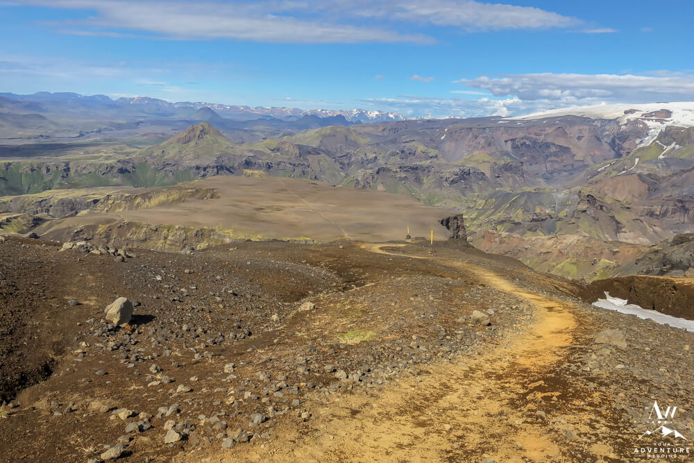
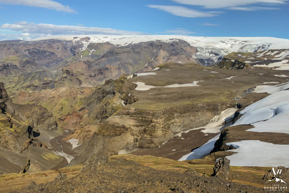
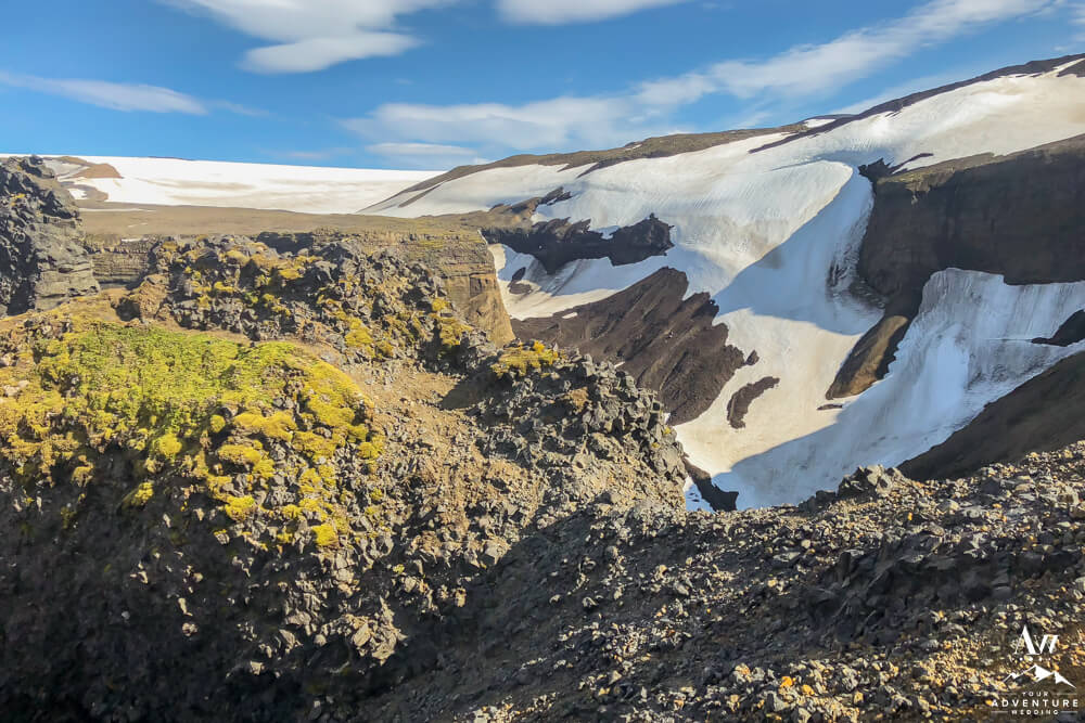
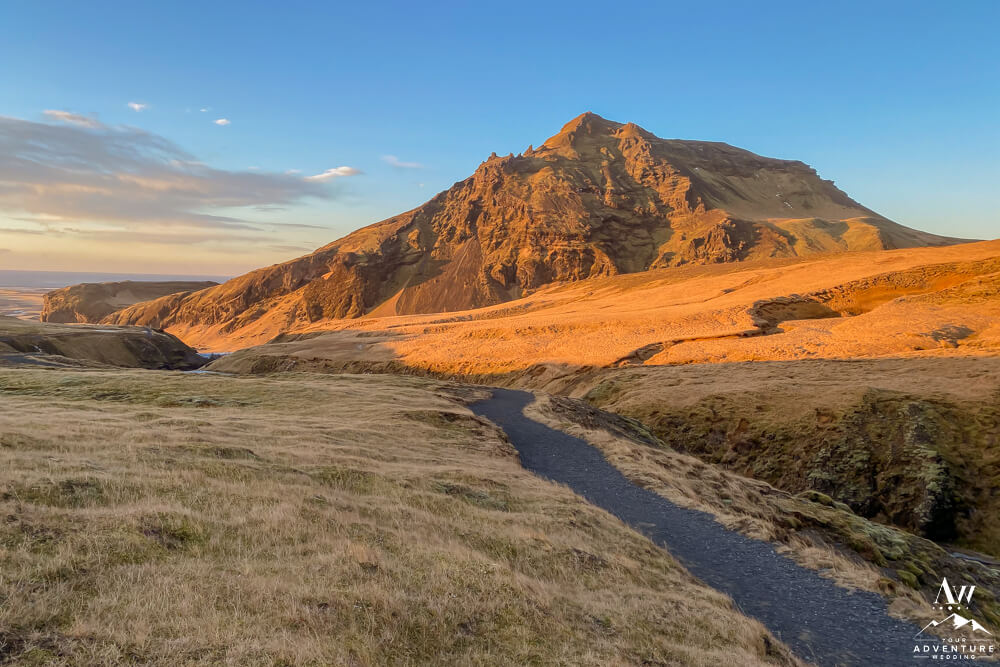
Hiking Between 2 Glaciers & 2 Volcanos in Iceland
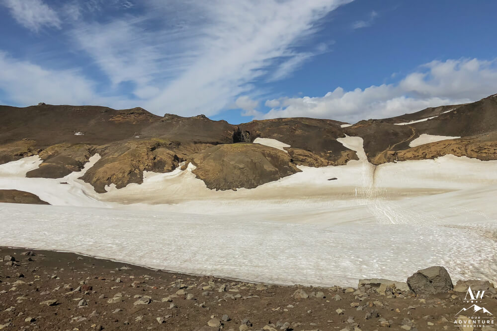
Following the bridge crossing over the Skógá River, this is where the landscapes change significantly. For example, you say goodbye to the lush greens and welcome in more desolate barren landscapes of sand, lava rocks, and likely leftover snow / ice from the highland winter. Meanwhile, the first ~ 3 miles after the bridge to the Baldvinsskáli Mountain Hut will just be rocky sort of boring up and down hiking along a gravel track.
Likely after leaving the hut, you will encounter snow for the first time. Maybe this is the point you slide on your crampons. When we did the hike once in late July, I regretted not bringing them along with hiking poles. Why? Because it was hella icy and we really wasted a lot of time traversing safely.
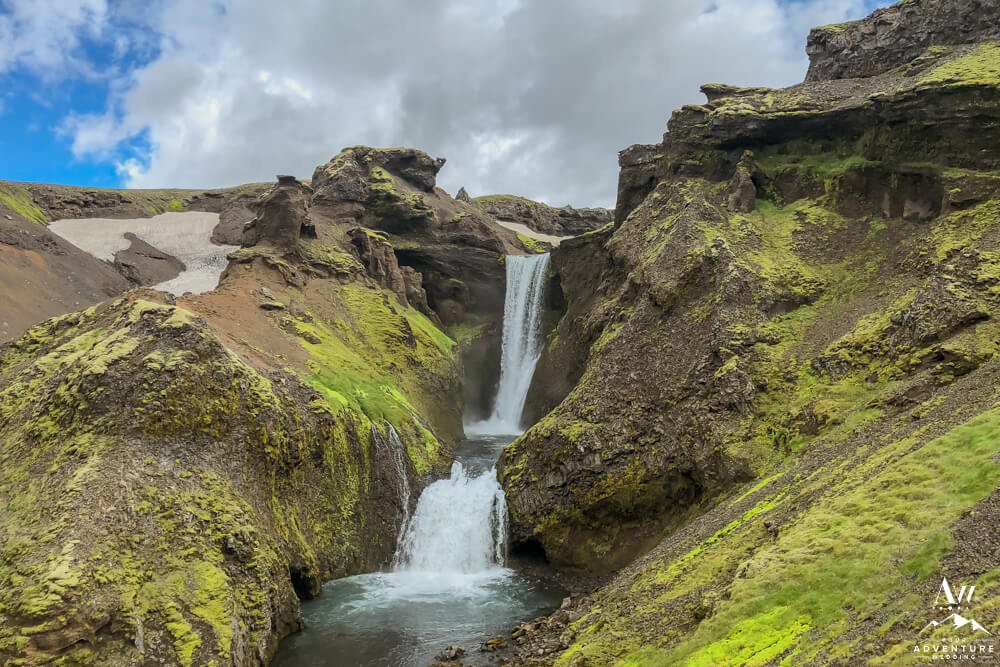
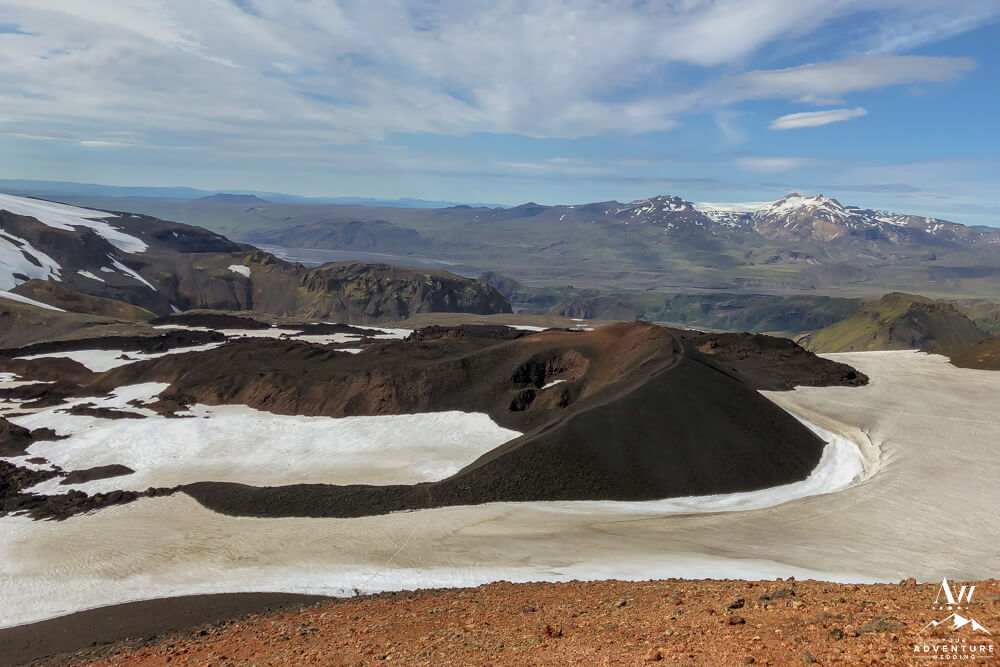
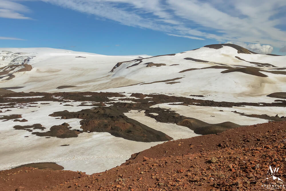
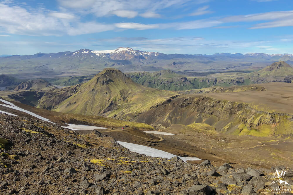
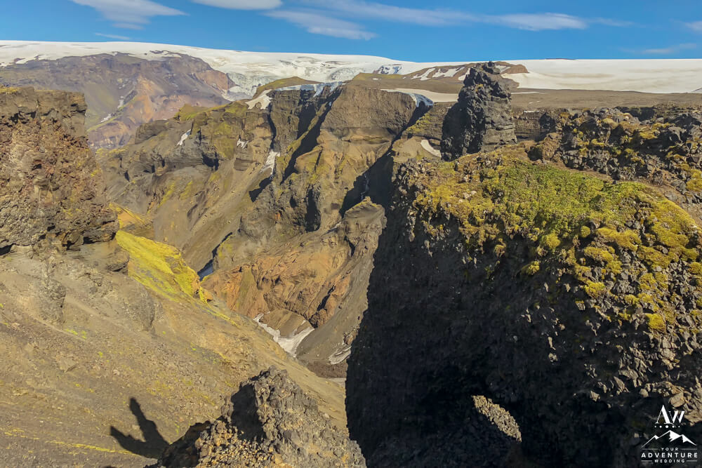
However, once you pass these two snow dipped icy areas you’ll make the challenging climb up to the Fimmvörðuháls Pass. Go You!! You Got This!! Next, this is the point now you will be hiking between 2 glaciers and new volcano craters. The left one being Eyjafjallajökull and the right being Mýrdalsjökull and the volcano craters being Magni and Móði. Keep reading for more step by step instructions…
-
- The snow valley we wished we had crampons for!
-
- Climbing up the Fimmvörðuháls Pass.
-
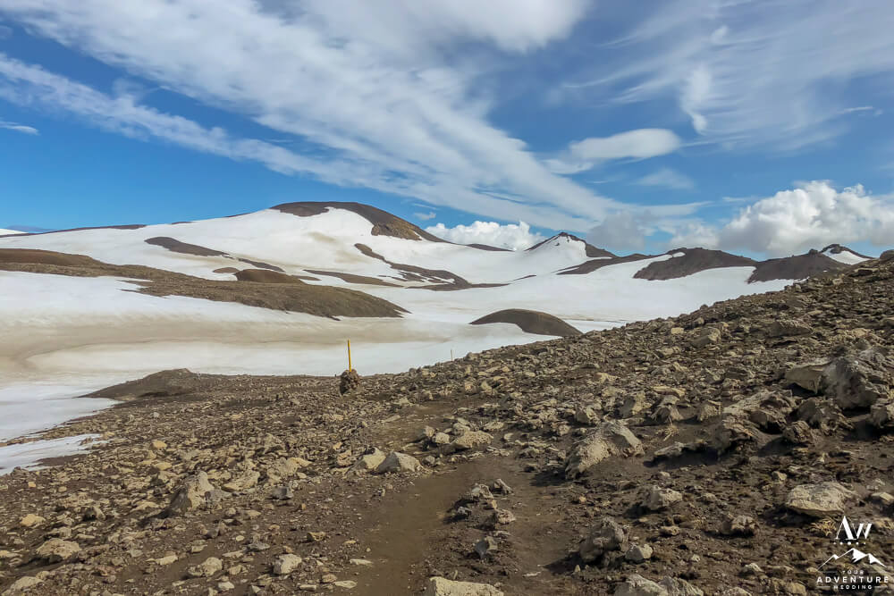
- Follow the yellow hiking stakes.
-
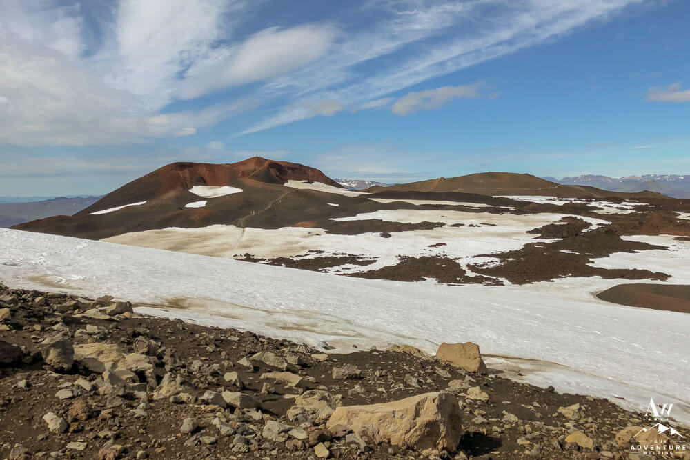
- Hiking between 2 volcano craters, Magni and Móði.
-
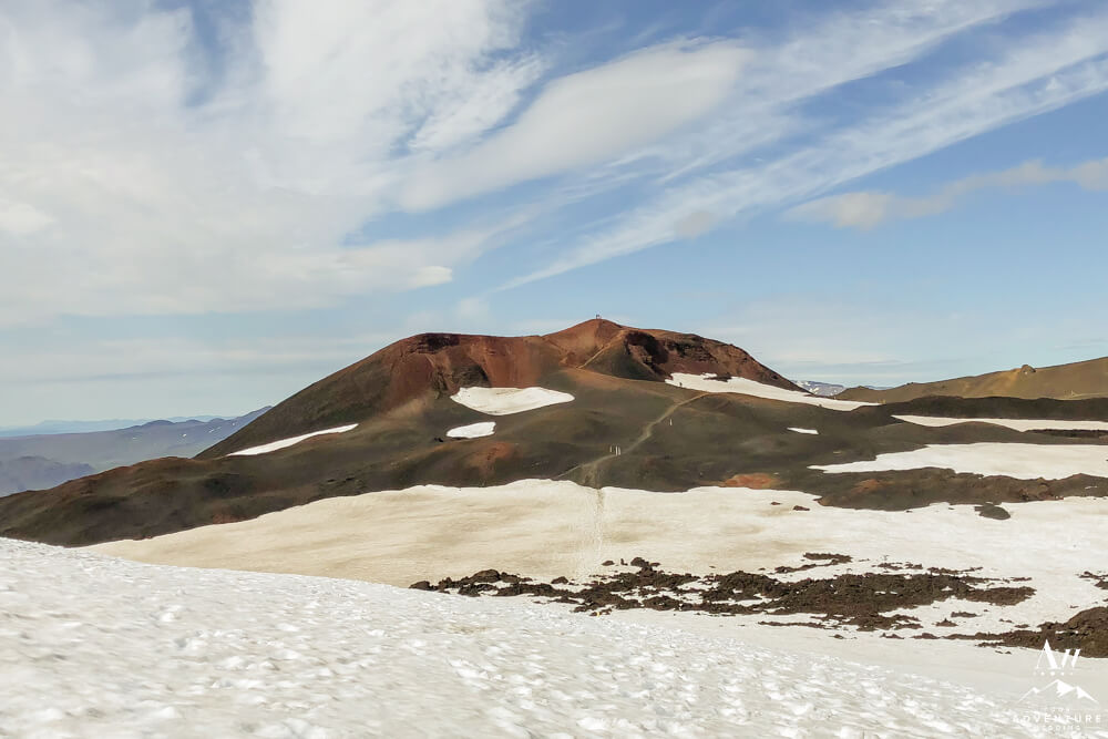
- Good news too, you can hike to the top of these fresh landscapes!
-

- This lava is new landscapes, created by the April 2010 Eyjafjallajökull eruption.
-
- If you embark on the hike on a crystal clear day you get endless views!
-
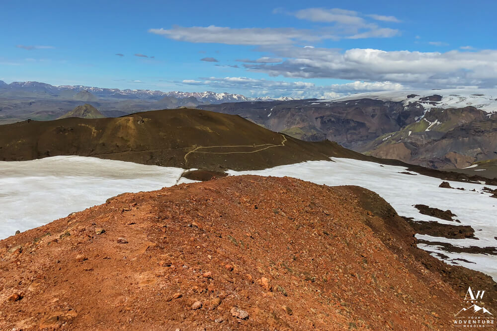
- View of the trail as you hike between the glaciers and volcanos.
-
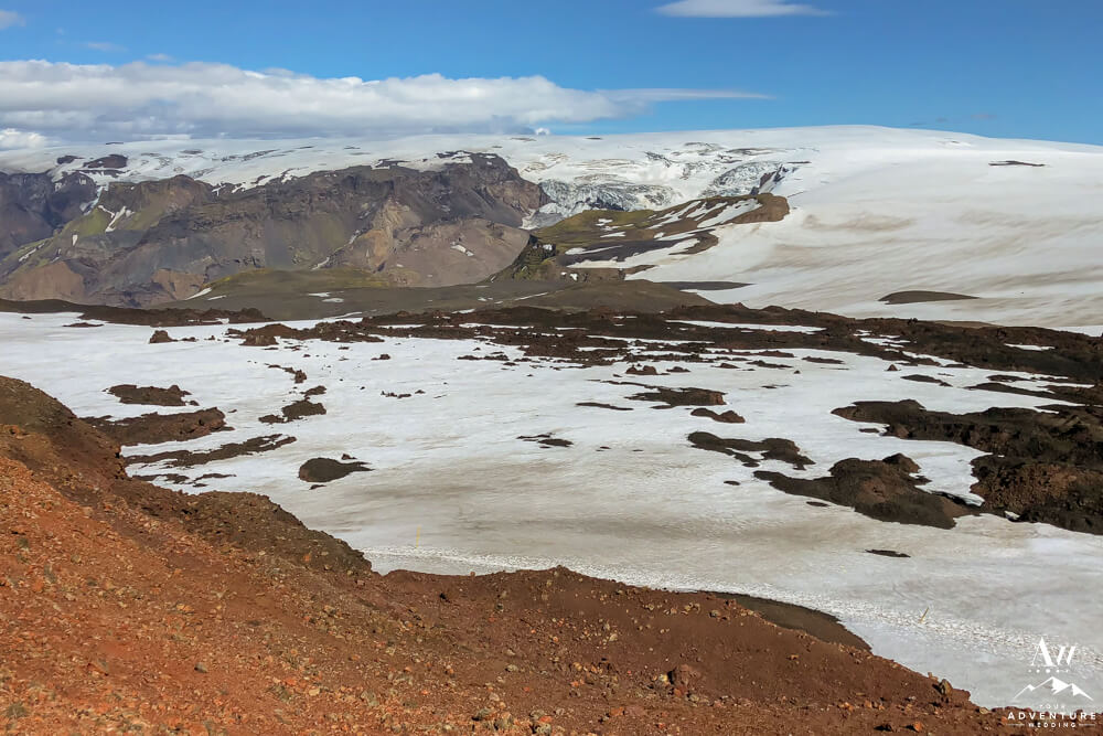
- 360 degree views!
-
- Take a break and savor it!
-
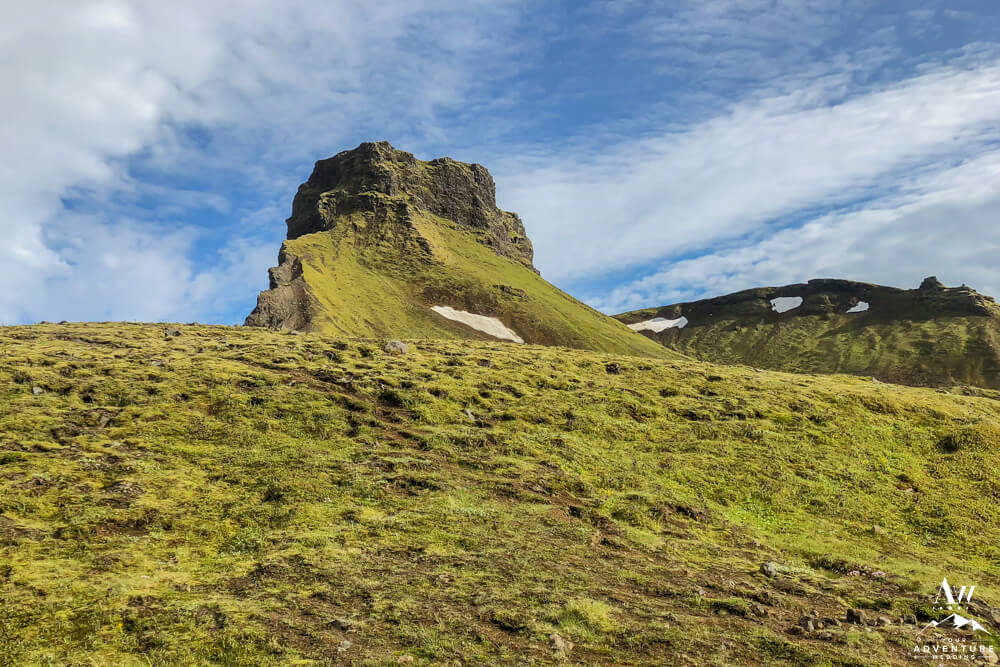
- Now the landscape changes one last time…
-
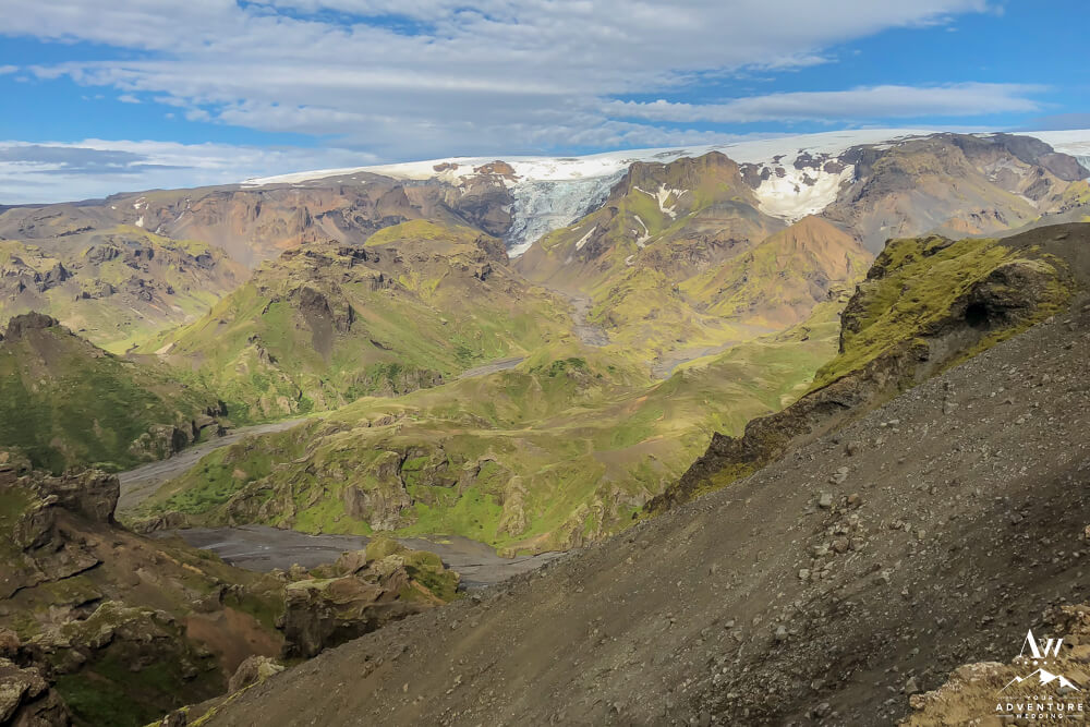
- Welcome to the hike down into Thórsmörk!
-
- All downhill from here, congrats!
-

- Be aware, some parts are steep so take your time and hold on to the chains or ropes if they are there!
-
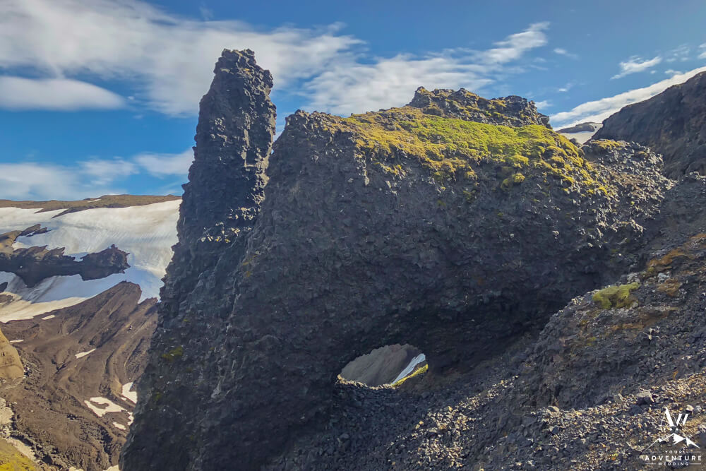
- The rock formations are really stunning, take note!
-

- Ascending down into the valley of Thórsmörk.
-

- Sunset at Básar Hut & campsite.
-

- Básar Hut & campsite the end of the Fimmvörðuháls hike!
Getting Married During the Fimmvörðuháls Hike
Are you enthralled by the idea of getting married during your Fimmvörðuháls trek? Well it’s possible! But several areas of the landscape cross into private or protected property so it’s important to get the right permissions / permits ahead of time. Which is exactly why hiring a local Iceland Wedding Planner is a good investment. And if you seek less trafficked awe inspiring locations, feel free to contact us!
Craving More Adventurous Hikes?
© 2022, Photos by Miss Ann (DBA Iceland Wedding Planner / Your Adventure Wedding), All Rights Reserved.