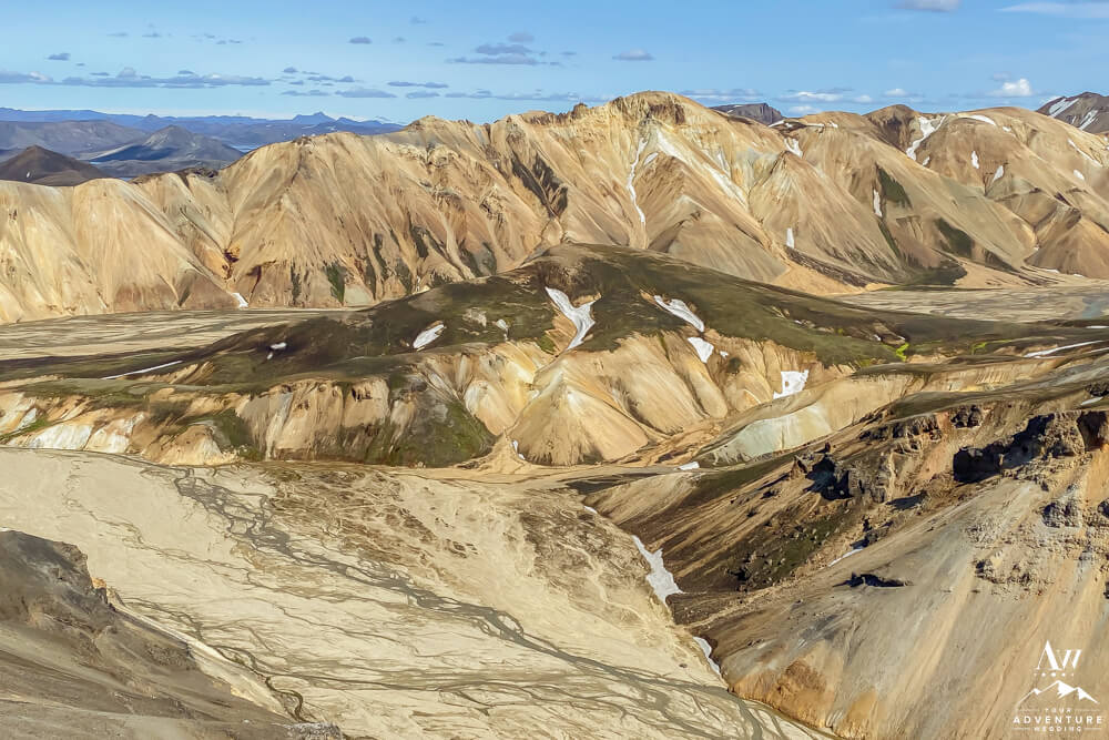
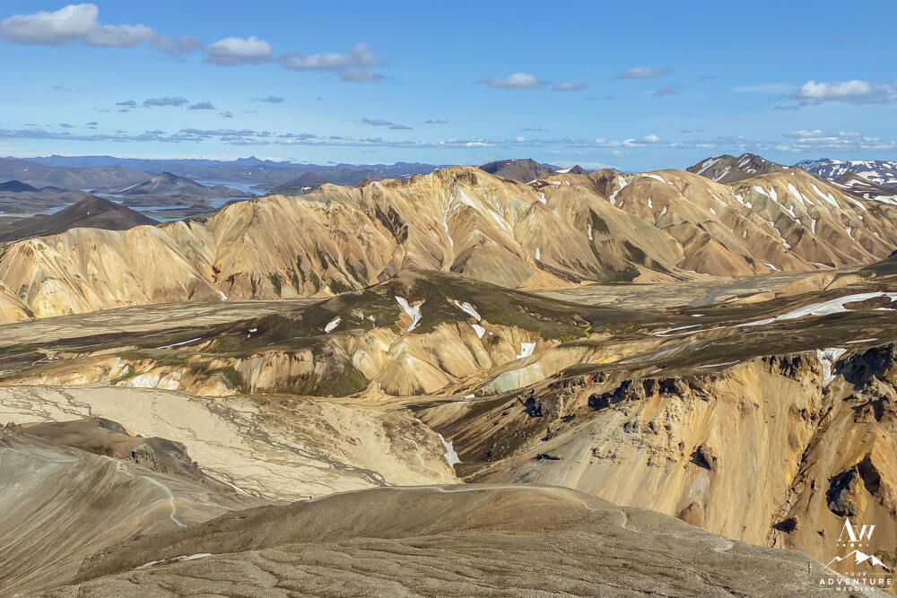
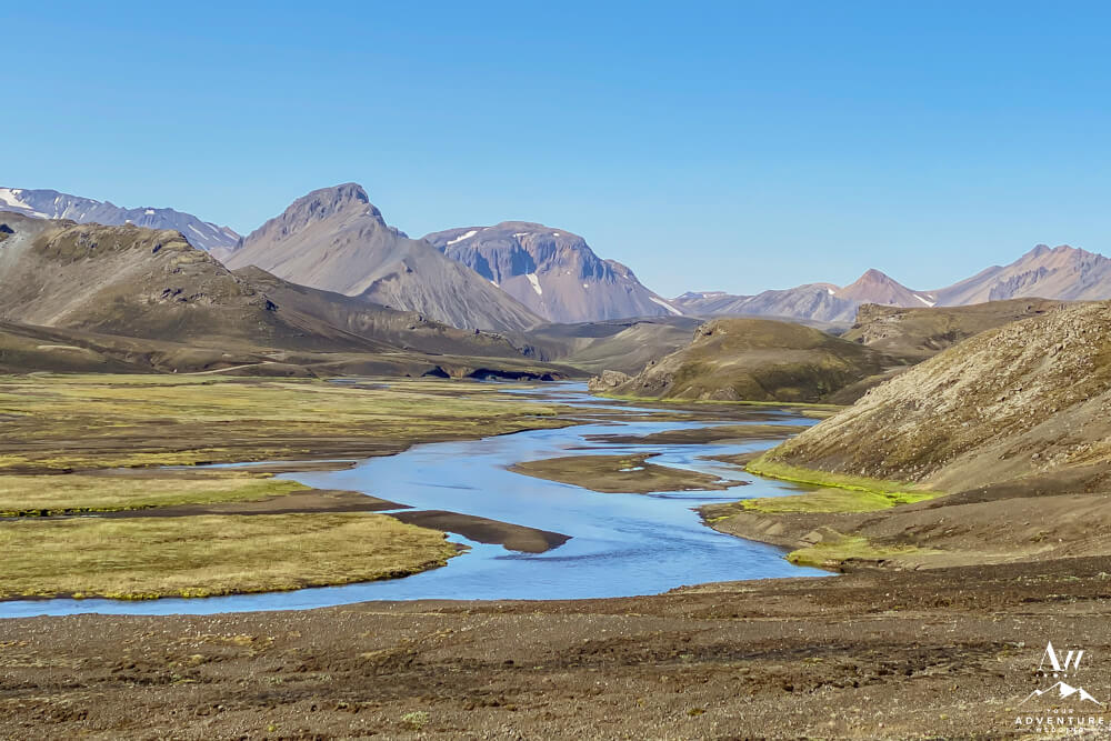
Travelers come to Iceland for our iconic landscapes. And one of those epic places is folks wanting to experience the colors of Landmannalaugar. Standing on the brink of the Laugahraun lava field, this volcanic geothermal area was created in 1477 so history runs deep! During the summer months, this vivid location is flooded with hikers, day trippers, and campers. But how do you get there and what is there to do when you’re there? Allow our Iceland Wedding Planner team to educate you…
How to Get to Landmannalaugar
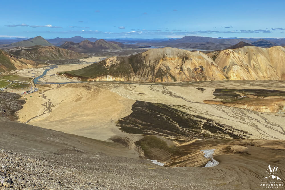
Likely, after seeing the above image or similar, you might become obsessed with getting to Landmannalaugar to experience it yourself. Am I right?! Well, you’ve come to the right place for all the details… To illustrate, most of us on the Iceland Wedding Planner team have spent a lot of time up there personally hiking, camping, and stand up paddle boarding throughout the years on our off days.
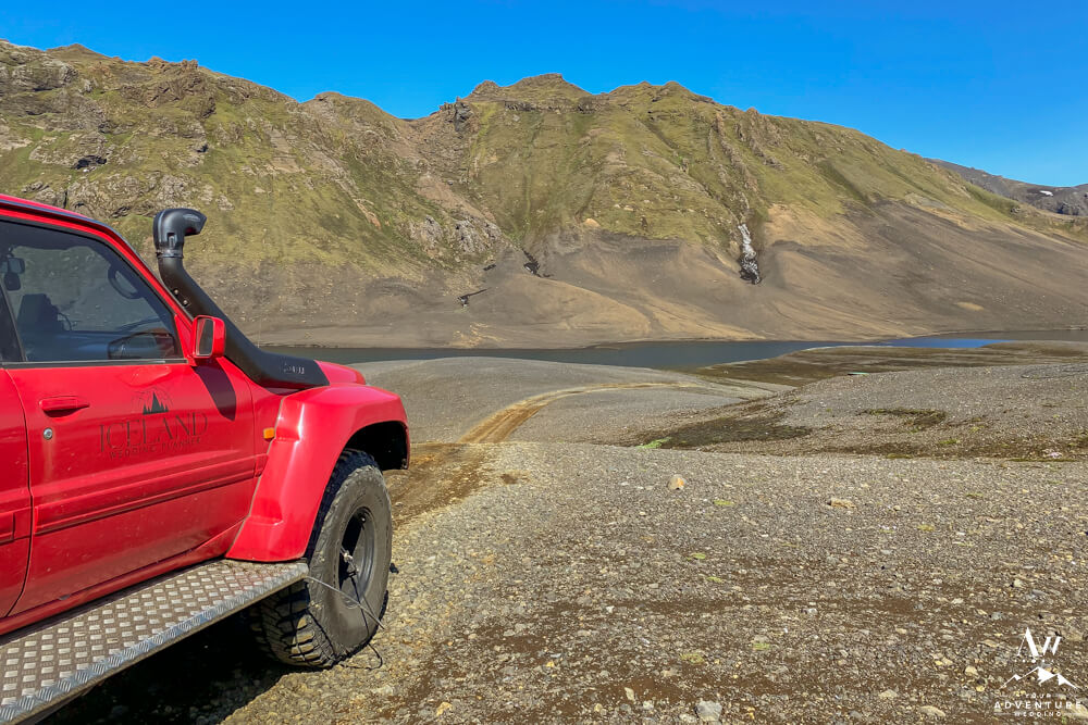
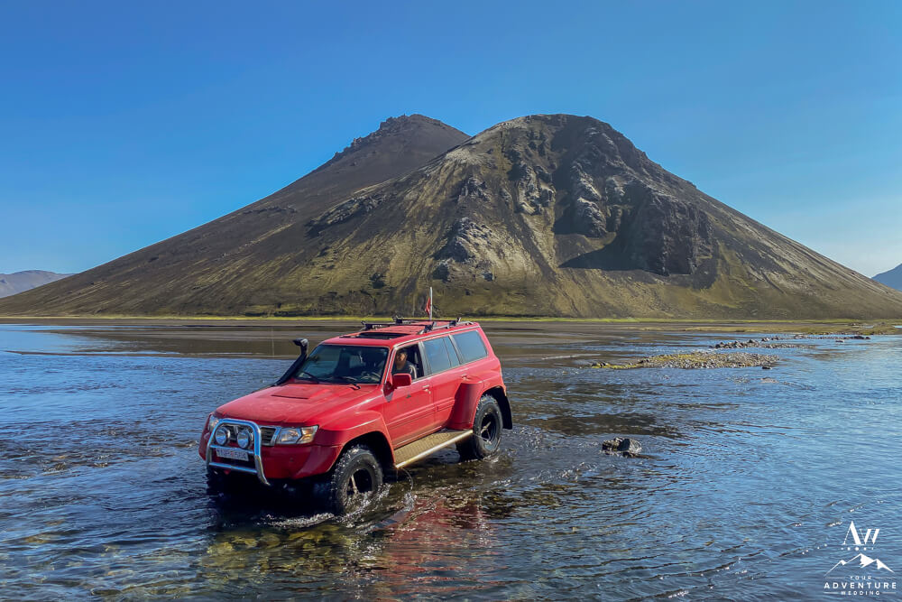
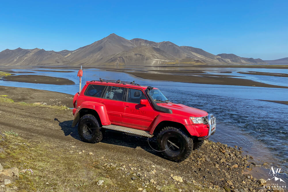
Firstly, it’s important to know if you intend to drive yourself, you can only do so during the summertime (early to mid June – August) safely. Why? The roads that leadto there are “F-Roads” which are often un-serviced mountain roads (deep ruts, mud, river crossings, etc). Also due to snow levels and difficult road conditions that could wreck or sink your rental. Therefore, if you are coming outside of that timeframe or are not renting a capable 4×4 that is approved to drive on “F-Roads,” then it is best to hire a local, licensed, and experienced tour guide. After all getting stuck can really ruin your day.
Choosing Your Route:
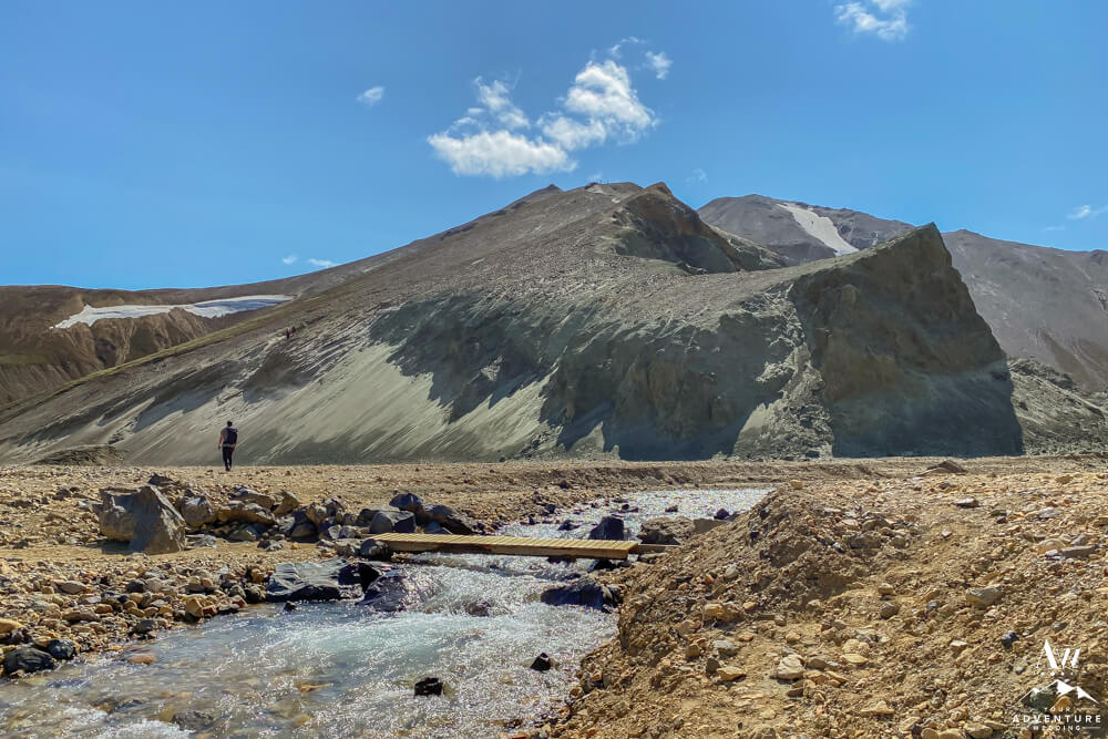
Secondly, there are 2 routes into Landmannalaugar. For instance, one is through F26 and F208 and the other is through Landmannaleið which is also called F225 (which passes by Rauðufossar). However, the easiest (least river crossings) and shortest route to drive into Landmannalaugar is the first F26 to F208. Furthermore, it is just under 3.5 hours from Reykjavik. For example, you can follow Google Maps but also know you go from Route 1; to Route 30; right onto Route 32; to F26; to F208 to F224. Next, you’ll park in the main lot and then walk over the rivers via the foot bridges. Lastly, here is Landmannalaugar GPS Coordinates: 63.990646, -19.0628939 if you need!
A Word of Warning:
Do not try to cross the rivers into the campsite / hot spring area unless you have a super jeep or higher clearance 4×4 with snorkel. Also, it is always good to check out the weather forecast on Vedur and the Safe Travel websites before making your journey as rivers can swell and conditions can change.
Landmannalaugar Things to Do
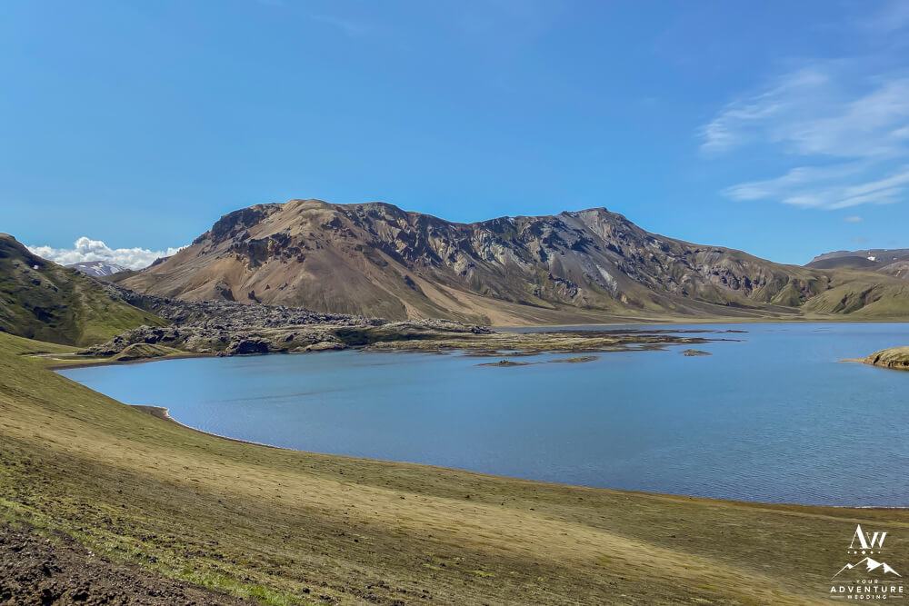
Once you are in the middle of this vivid highland area of Iceland, you may be curious to know what you can do! To illustrate, here is a list to get you started as you plan your Icelandic highlands trip…
- Photography here offers endless options on the way in or even just from the base camp area.
- Camp in the mountain hut (book in advance) or bring your own tent and gear.
- Geothermal Pool named, “Pool of the People.” NOTE: If you’re a day visitor you need to make sure you visit the Hut Warden to pay the entry fee and shower first!
- Epic Day Hikes
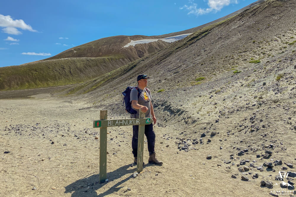
- Bláhnúkur (Blue Mountain) is the hike we are highlighting in today’s Iceland Wedding Planner post. Therefore read our step by step guide below!
- Brennisteinsalda (Sulfur Wave) is a slightly challenging day hike that is about 4 miles long and you can expect to spend 2 – 3.5 hours doing it.
- Laugahraun Loop is a super popular hike in Landmannalaugar. You can expect to hike just under 3 miles in 1.5 – 2 hours.
- Bláhnúkur – Brennisteinsalda Loop combines the best views if you’re ready to take on a more challenging longer day hike. For instance, you can expect 6 miles of hiking somewhere between 4.5 – 6.5 hours.
- Other hike a short drive away: Ljótipollur (ugly puddle). 4.5 mile loop will take you around the edges of the crater and take you about 2 – 3 hours.
- Begin the Famed Multi-day Hike: Laugavegur Trail
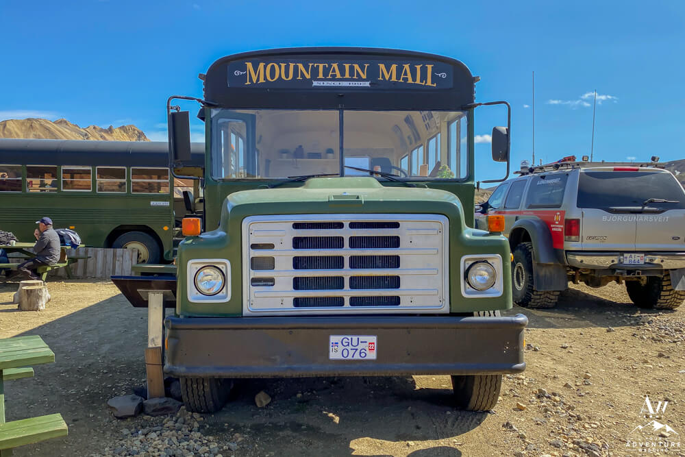
- Buy something from the Mountain Mall.
- Have drink or meal in Fjallafang Cafe.
- Bring your own picnic rations to have in a picturesque spot! Please make sure you leave no trace behind you though after!
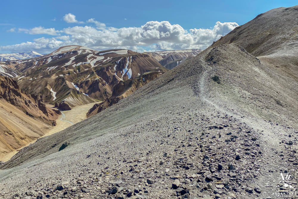
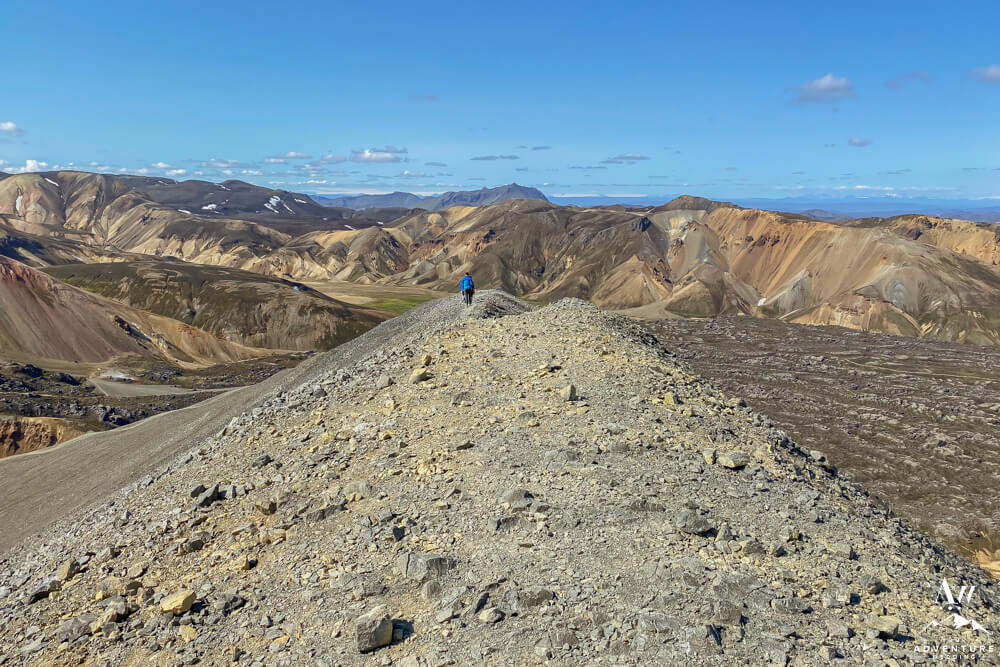
Bláhnúkur Hike Guide (Blue Mountain)
Meanwhile, if you’re game to hike during your time in Landmannalaugar, allow us to share with you our favorite trek, Bláhnúkur summit!
Bláhnúkur Hike Specs:
- Hike Starting Point: From Landmannalaugar Base Camp.
- Distance: Approximately a 4 mile loop hike.
- Hike Time: 2-4 hours depending on your pace.
- Best Time of Year to Hike: June – August
- Elevation: ~ 1,256 feet high
- Terrain: Loose stones, dirt, dust (if dry), mud (if wet), lava rocks, and foot river crossing.
- What to Wear / Bring: Dress in layers, check the weather in Iceland before you go, water, snacks, hiking boots which have ankle support, and hiking poles (if you’re an unstable hiker or like to use).
To illustrate, feel free to use this step by step guide to experience it…
Bláhnúkur Hike Directions:
-

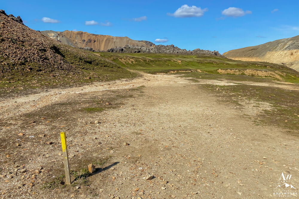
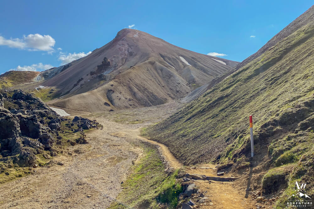
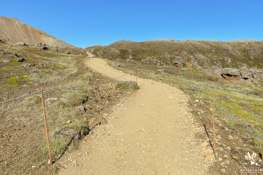
- Firstly, from the campground area, you’ll go over the hill towards the horse stable area to the right (you’ll see these mountains on your left).
-
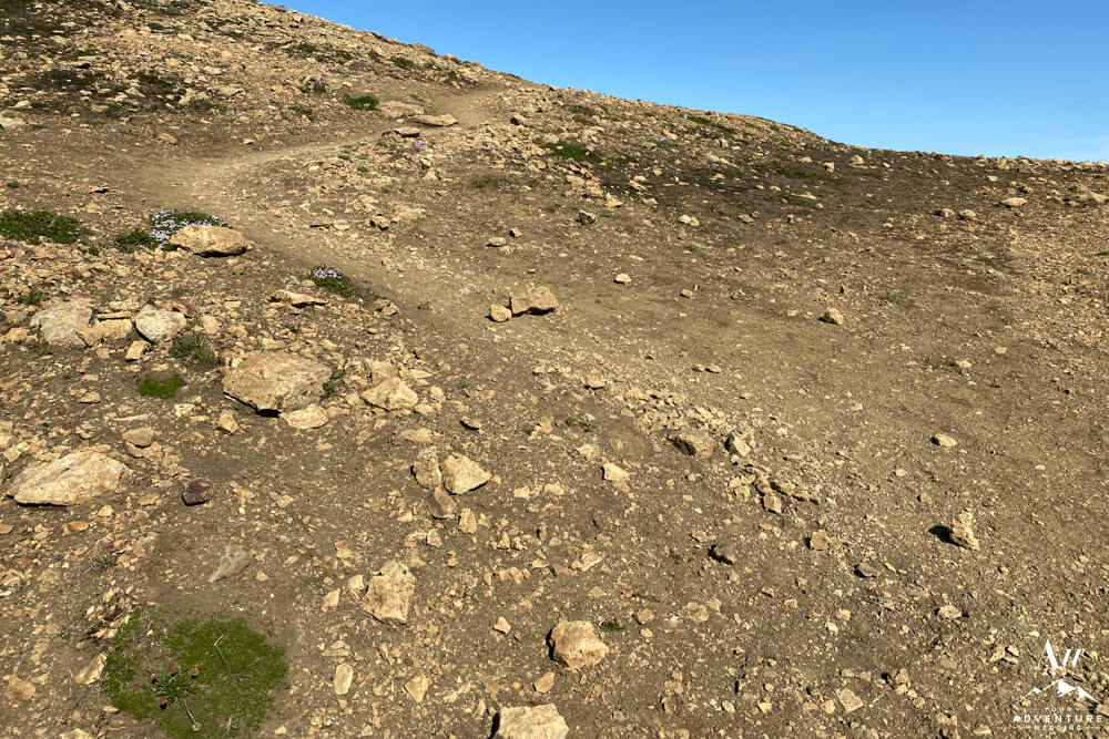
- You’ll notice the path consists of dirt and rocks. With lots of rain it can become muddy.
-
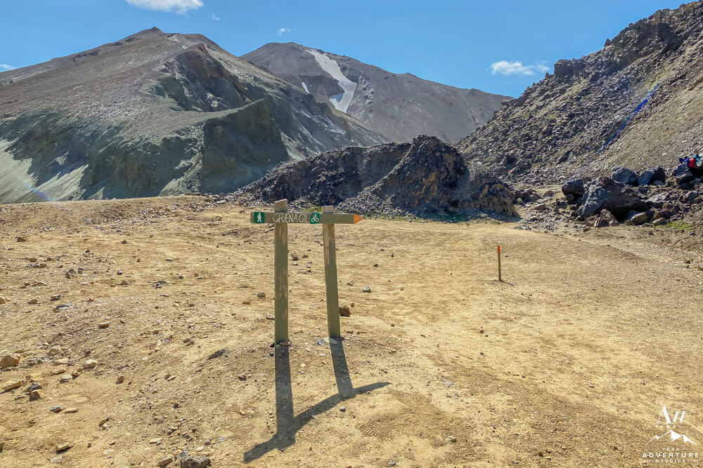
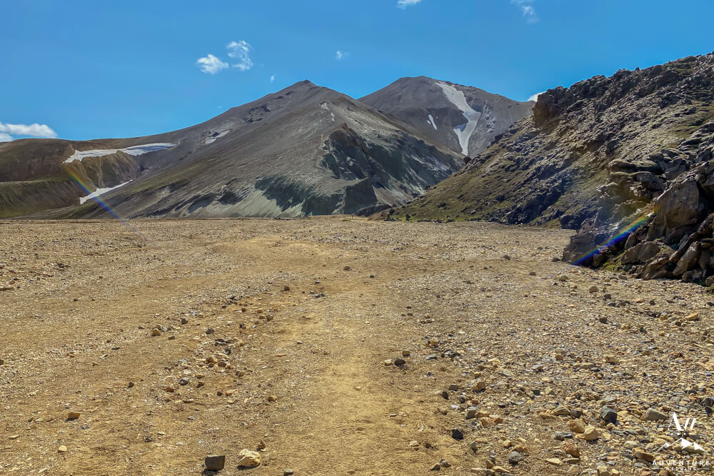
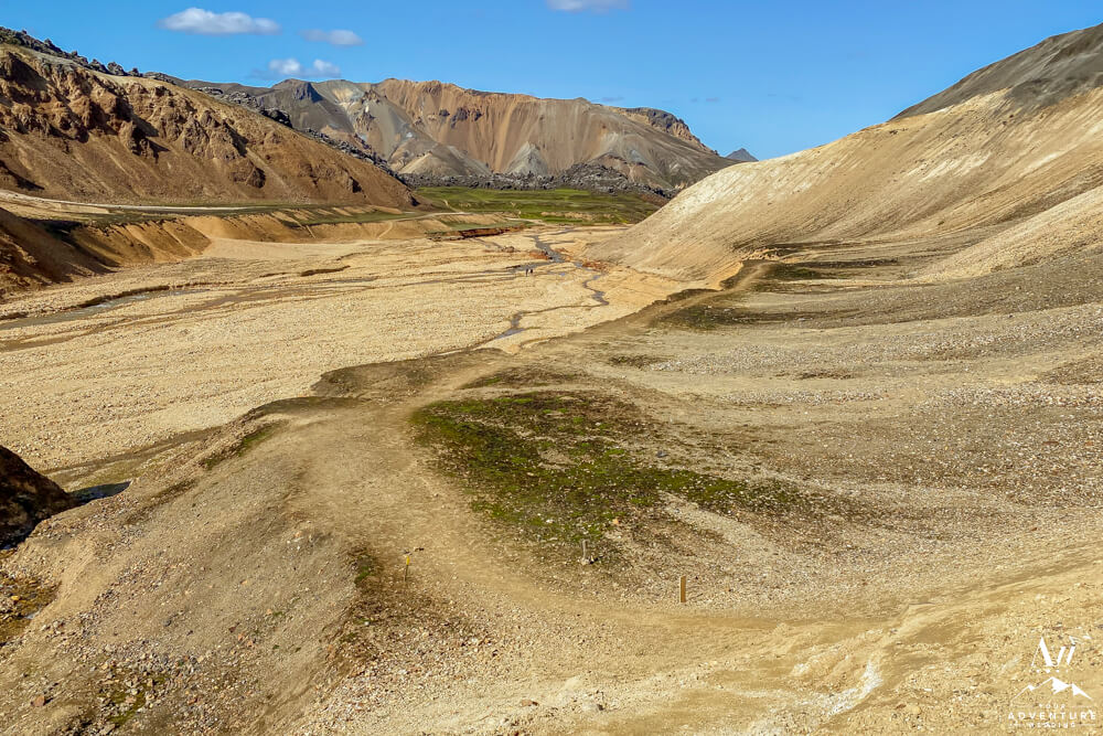
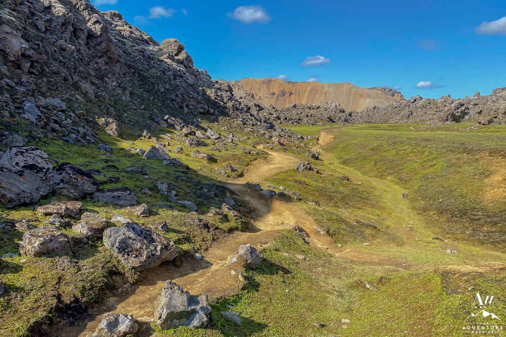
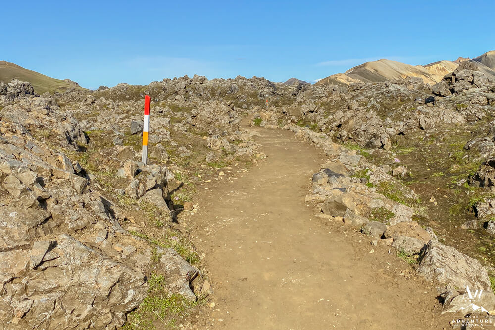
- Secondly, you’ll pass by the side for the “Green Mountain” hike which goes back into the bottom side of the valley. Keep heading forward towards the river crossing.
-
- Third, you’ll veer to the left and cross the small foot bridge.
-
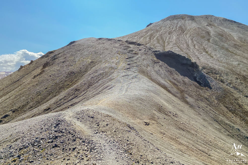
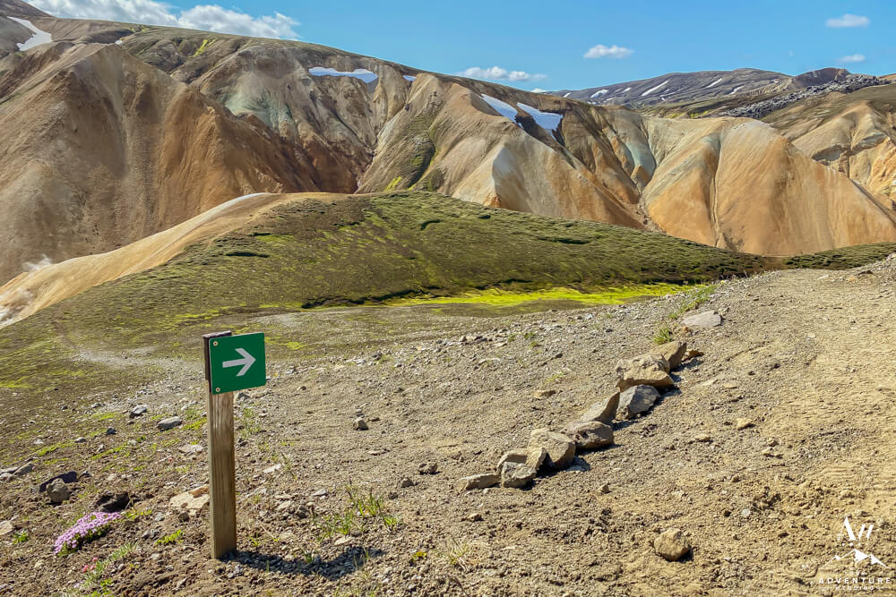
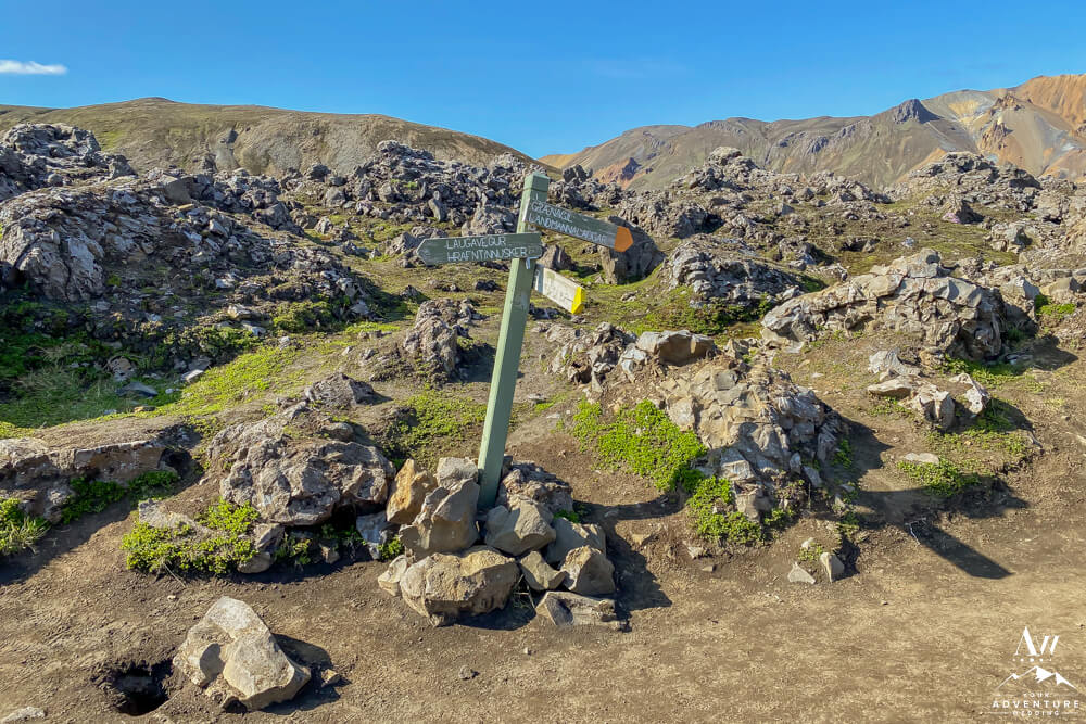
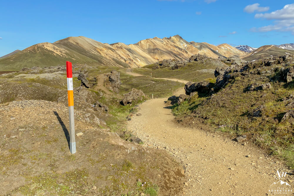
- Forth you’ll find the formal sign and trailhead for Bláhnúkur.
-
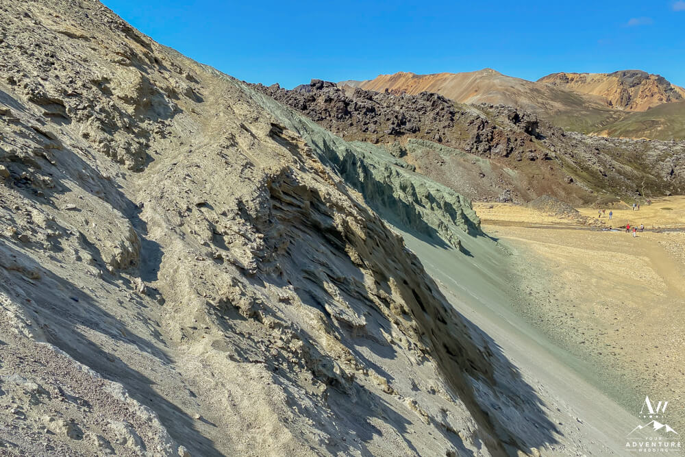
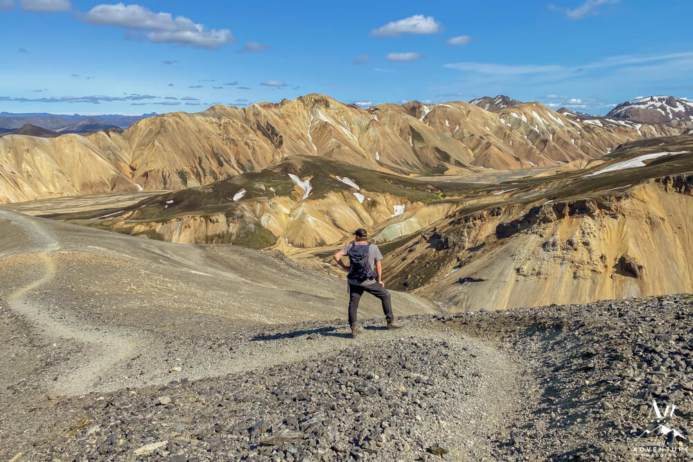
- Once you see it, you begin traversing up the green / blue mountain.
-
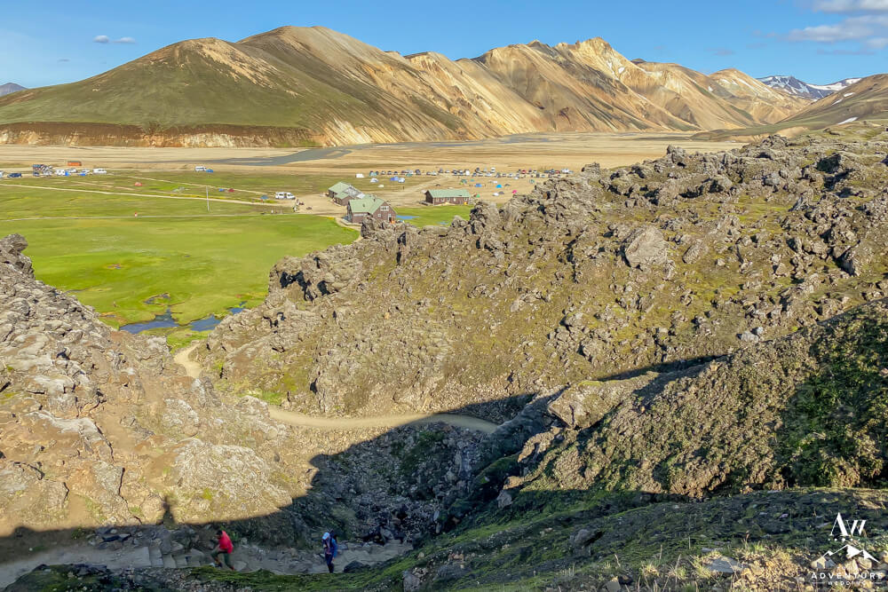
- View looking back on the trail.
-
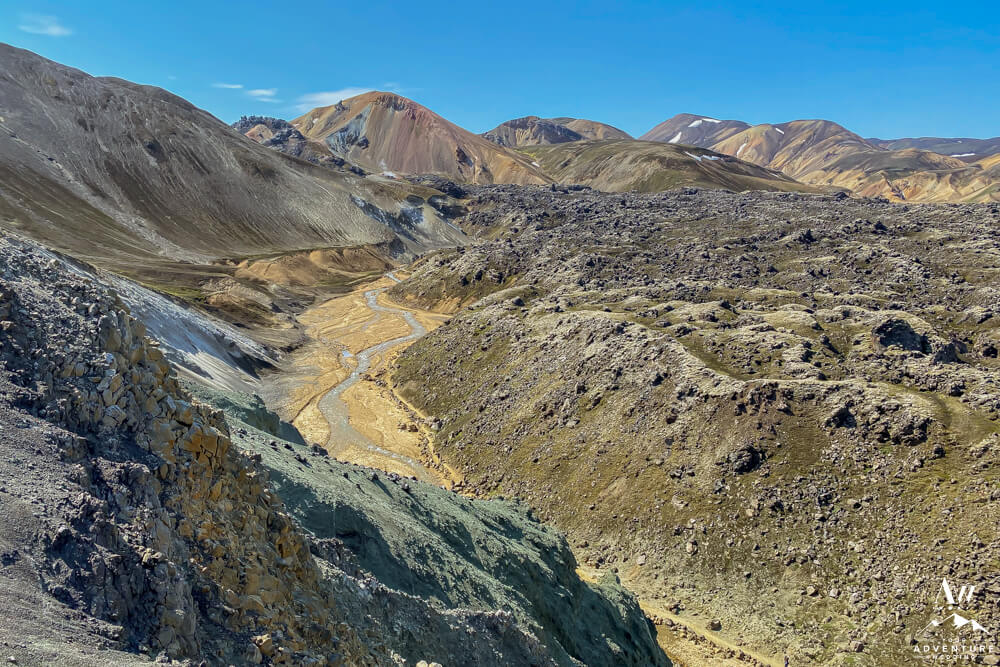
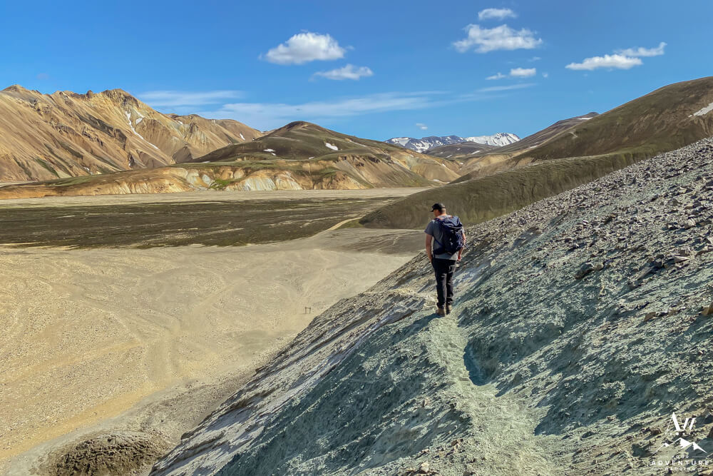
- Views are instant even from this low altitude.
-
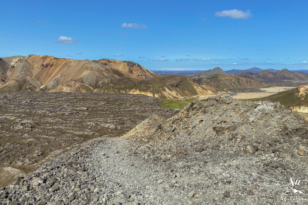
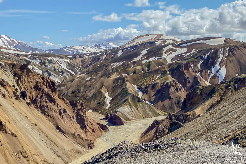
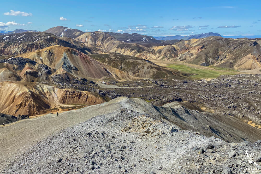
- The view of the Laugahraun Lava Field really takes shape from this hike!
-
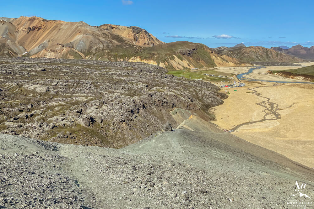
- View looking back towards the Landmannalaugar campground. Bring hiking poles if you’re an unstable hiker.
-
- 1/4 of the way up to the summit view.
-
- Be aware the trail has loose rocks so take caution and wear solid hiking boots.
-
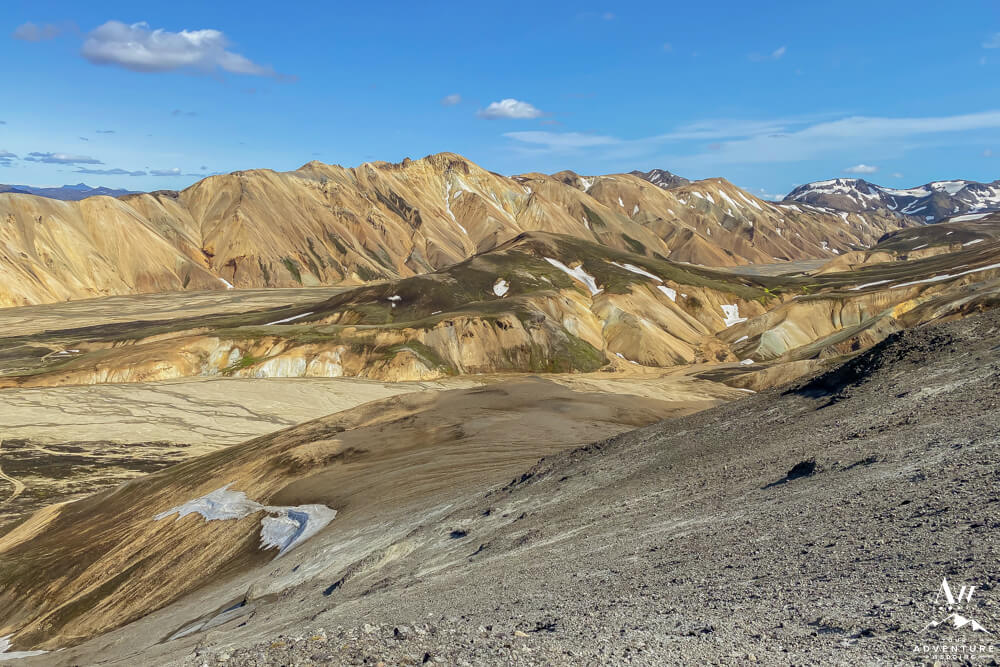
- On a good weather day the views are phenomenal!
-
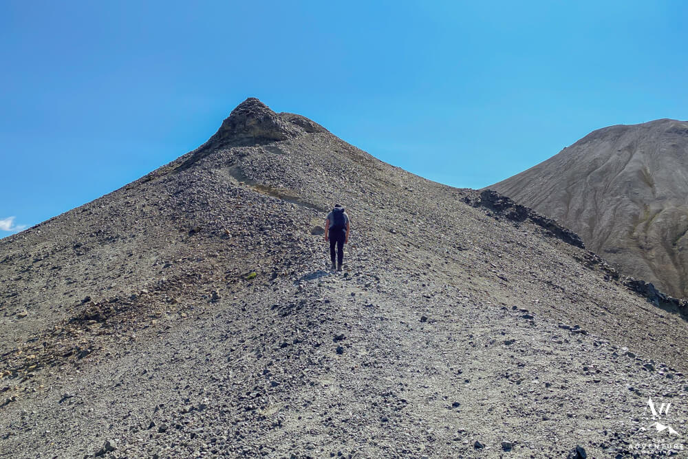
- It’s going to feel like this spot is the summit but it’s not. Likely the half way point once you’re up!
-
- Once you’re up that hill this is your view! High five!!
-
- The campground looks so tiny!!
-
- Another midway hill to conquer…
-
- Push through this part and you’ll be 3/4 of the way to the summit!
-
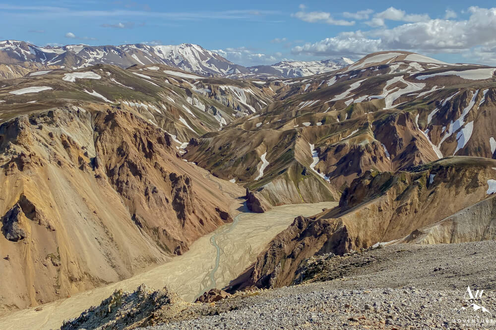
- Then you’ll be rewarded with these views…
-
- Indescribable, really!
-
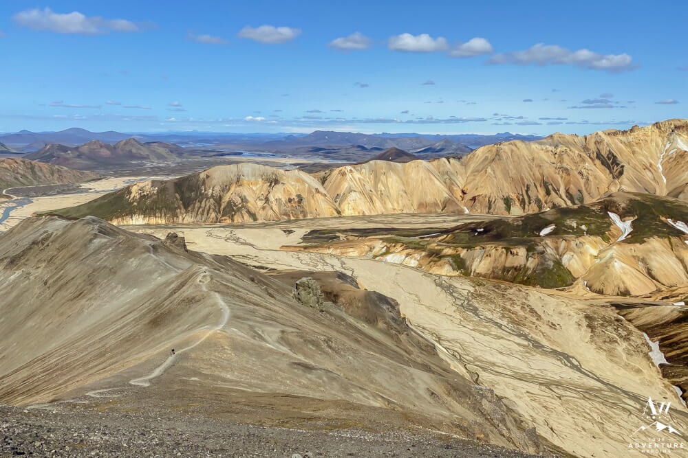
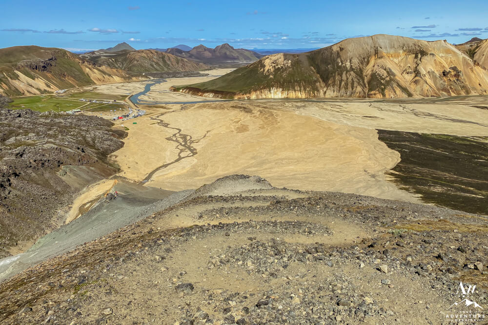
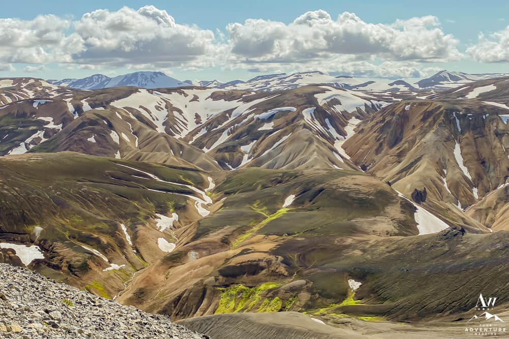
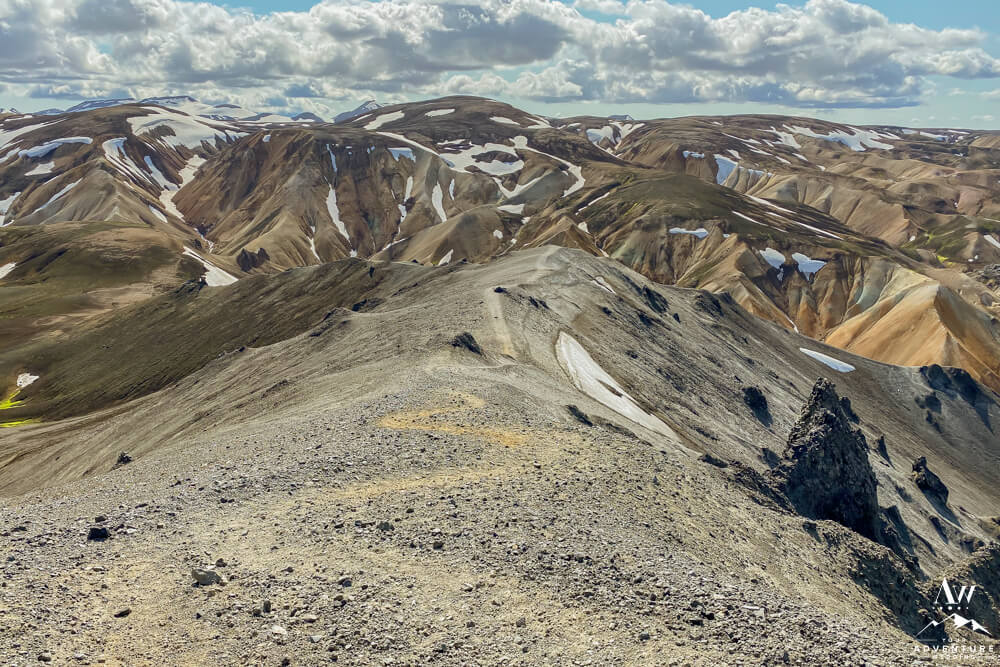
- In fact, at this height you’ll begin to see the lakes emerge in the background.
-
- The valley views also open up at this height!
-
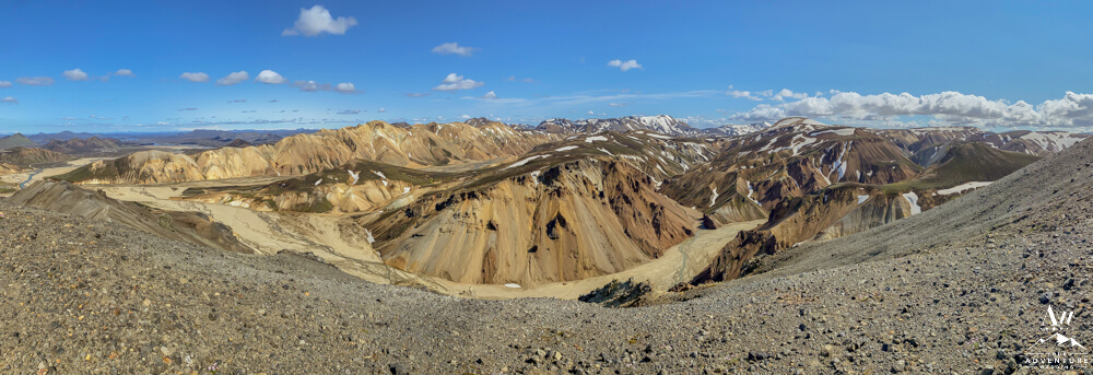
- Landmannalaugar pano view just for fun 😉
-
- Look at those colors!!
-
- Looking back on the trail view.
-
- You made it to the top, bravo!
-
- You’ll feel so accomplished looking at the trail too… You just did that!
-
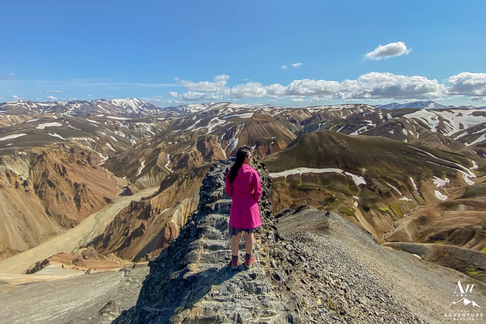
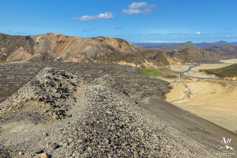
- Looking out from the Bláhnúkur Summit.
-
- Watching other hikers make their way up to the Summit.
-
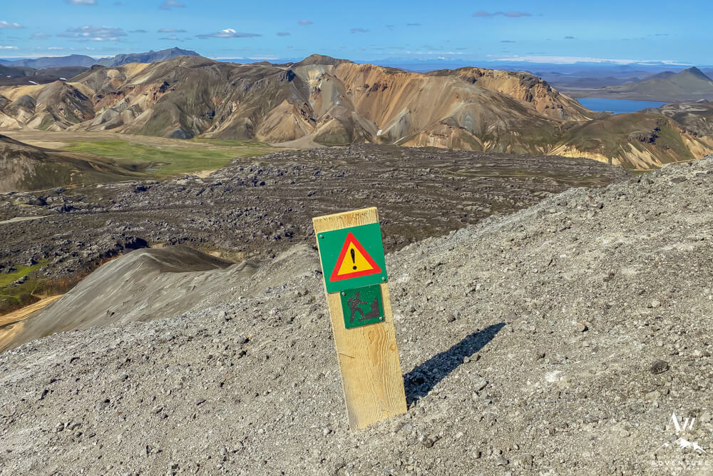
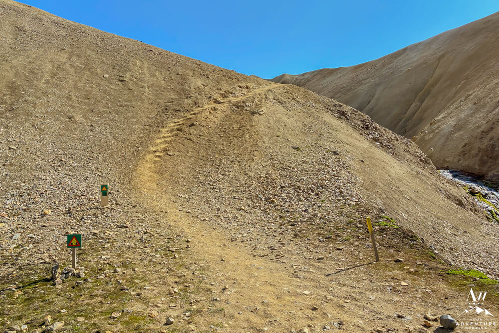
- Notice and respect the signs to stay safe!
-
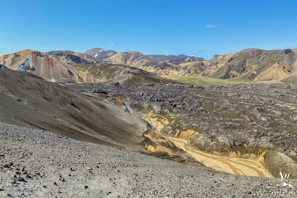
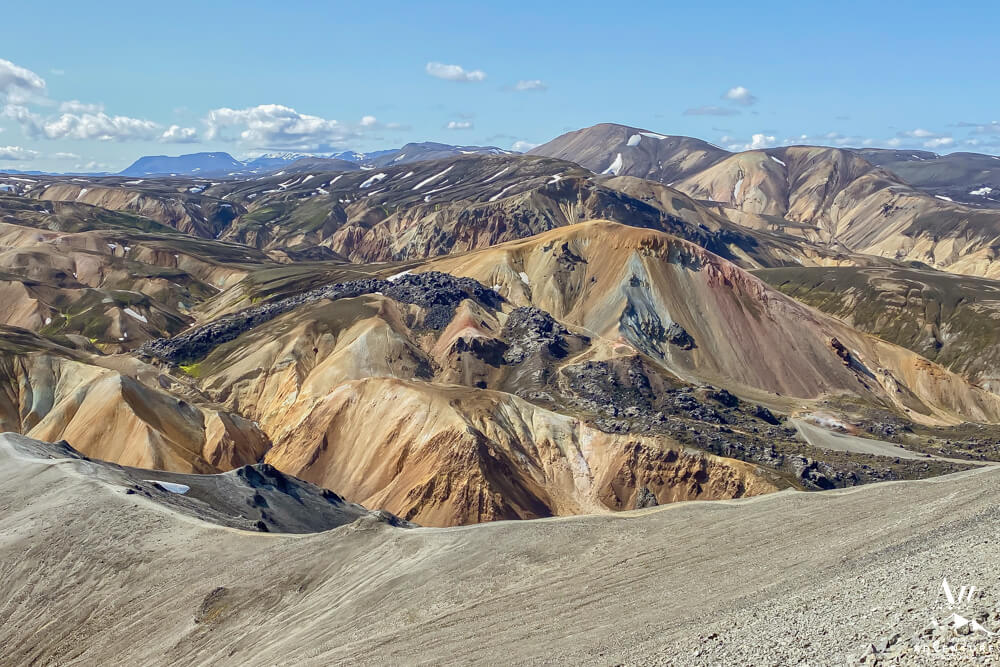
- View from the Summit looking out to the famous lava field.
-
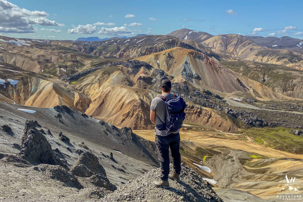
- Savoring the vivid views. Image taken in July 2021.
-
- Last look back at the trail…
Choosing Your Hike Back
Bravo you badass for making the trek to the Summit! Now it’s time to figure out what way you want to head back to the campground… First, you could head back the same way you came to continue taking in the fabulous colors. Second, you could do the route we did back which was through the Landmannalaugar geothermal area and lava field but it does require a deep river crossing by foot (like knee high on a 5’4” person).
-
- Hiking down the other side of the Summit.
-
- This is probably the only spot where I felt like where I wish had brought hiking poles. As it was super steep and loose rocks that made you slip and fall. Watching folks after us, they were sliding down on their bums.
-
- Green arrow signs keep you in line with the trail.
-
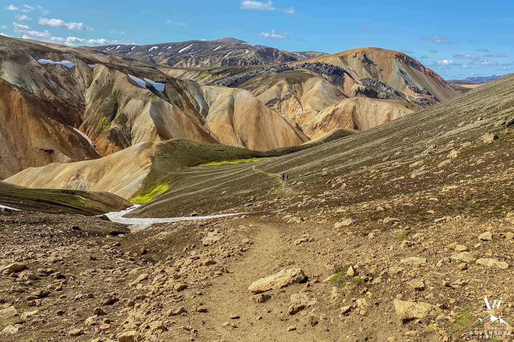
- Oh la la the view coming into the valley is stunning!
-
- Looking back on the trail.
-
- This is the point you need to pick a spot to cross the river.
-
- After you do, you have this view!
-
- Then you have a choice on direction…
-
- Go through the up and down of the lava field if you still have energy or detour through the geothermal area.
-
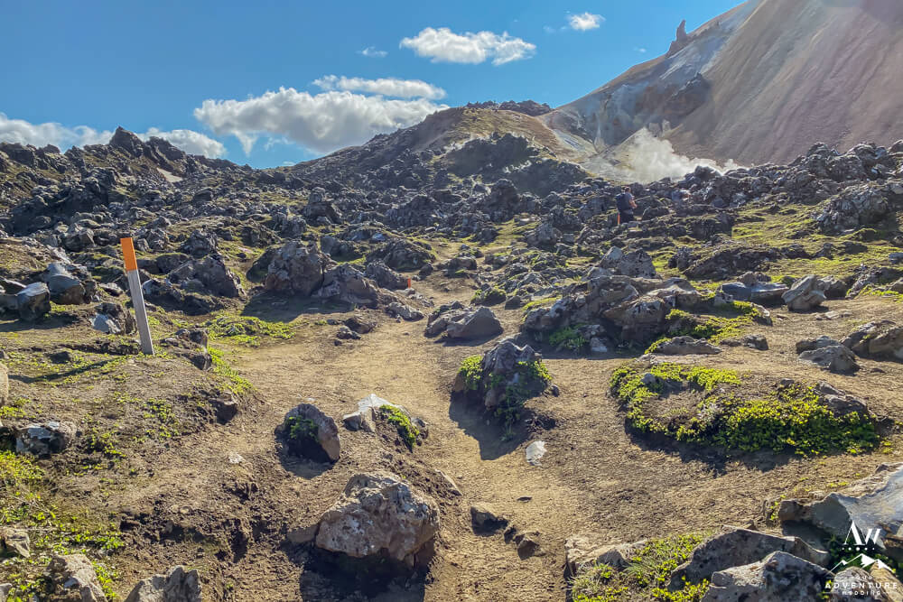
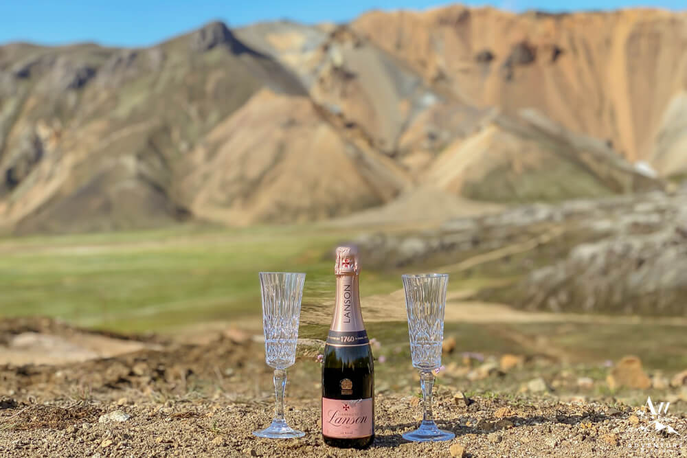
- We chose the geothermal area detour so we could enjoy champagne on the way.
-
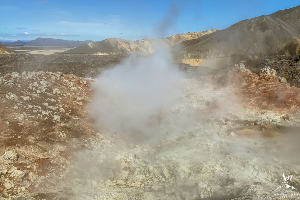
- View of the geothermal steam vent.
-
- This trail was probably the easiest we encountered all day.
-
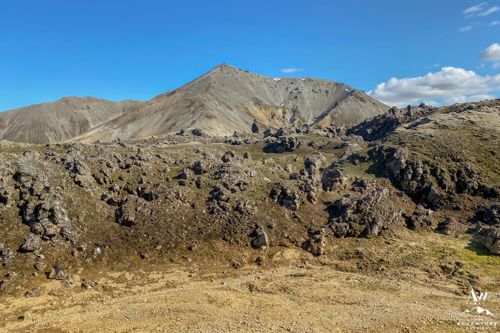
- Trekking alongside of the lava field was pretty cool.
-
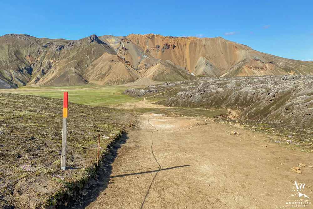
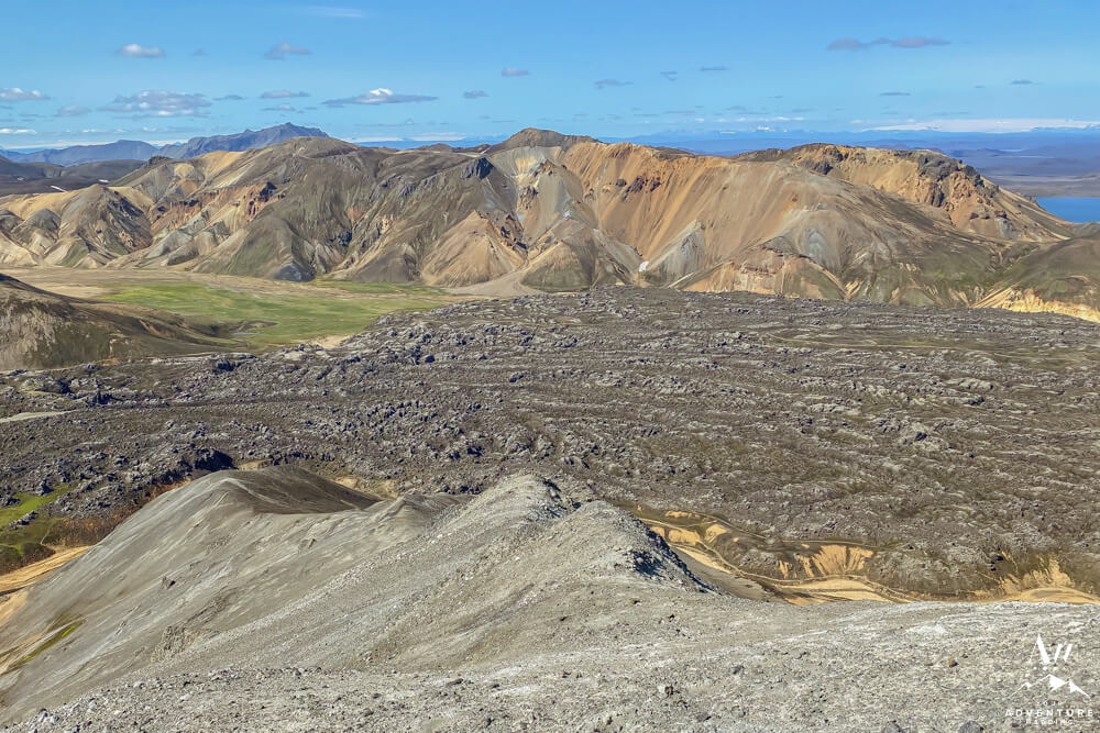
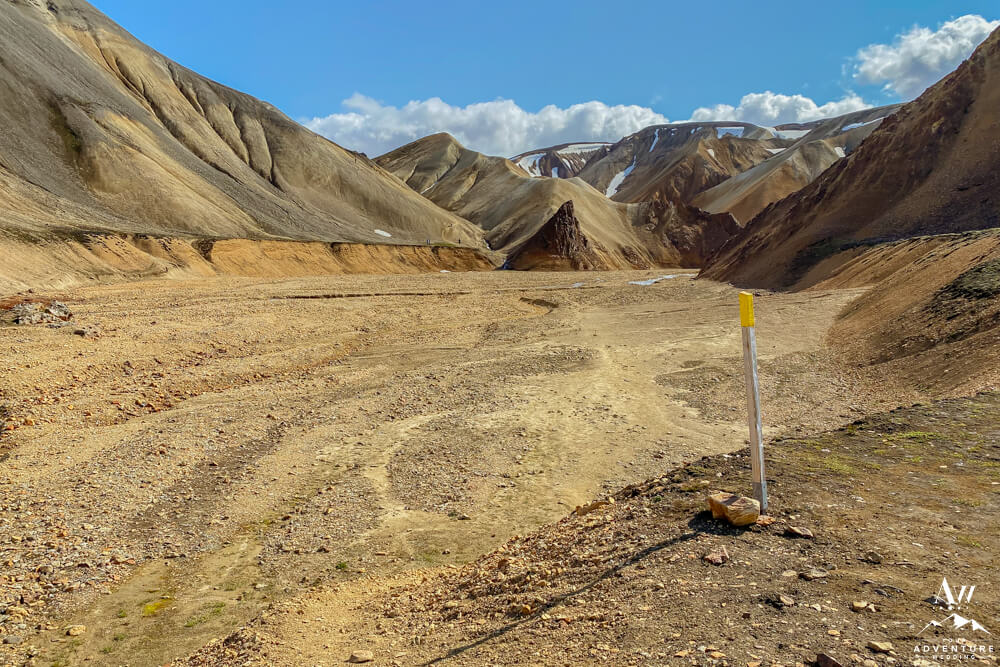
- Colorful mountain come back into view quite quickly.
-
- Next, the path becomes well marked and portected.
-
- Super impressive how well maintained the trail is, truly!
-
- The final leg of the hike just follows the lava and the view of the colorful mountains.
-
- Home stretch once you make your final ascent back into the campground area!
Marrying in the Icelandic Highlands
Are you crazy inspiried by this area? Maybe even want to plan your own Landmannalaugar elopement or adventure wedding here? Be aware that Landmannalaugar is within the Fjallabak Nature Reserve which means you need in advance permission / permits to hold a wedding ceremony here. It is best to hire a local Iceland Wedding Planner to help you through that process. Also, they will be able to educate you on what to expect, what to bring, pack, what transportation is best and you need to get yourselves to and from safely. Lastly, if you’re ready to begin planning your own badass hiking elopement we would love to know more about you both! Feel free to contact us to get that journey started…
Ready to Rock More Hikes in Iceland?
© 2022, Photos by Miss Ann (DBA Iceland Wedding Planner / Your Adventure Wedding), All Rights Reserved.